Maria Longley, GiGL Records Officer
© AskAuk.com
London’s open spaces weave through housing estates; grand London plane trees overhang busy roads; and gulls settle in wet patches of local football fields. Discover London is a great tool for a little armchair sightseeing of the 47% of Greater London that is green.Clicking on the intriguing shapes that outline London’s parks and open spaces will bring back a wealth of information on site uses and facilities, a description of the wildlife or habitats, and snippets of local interest or history.
You don’t have to click on many sites before their intriguing, unusual and sometimes downright odd names whet your appetite to learn more about the history and reasons for their naming. There are layers upon layers of history in the street and park names around us, spanning from the original Roman Londinium to the modern day city.
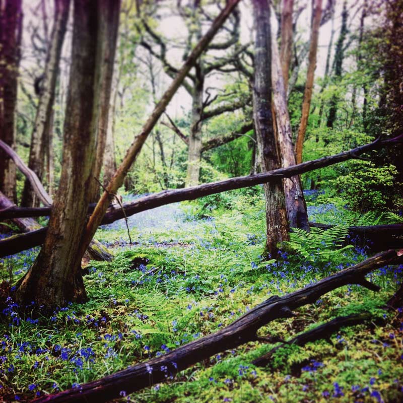
The first thing to notice is that many place names link us to the natural world; whether it’s harking back to the cranes that once lived in the Crane Corridor, to the still-present bluebells of Bluebell Wood, and fish of Fish Ponds Wood, or to the older trades of shepherdesses of Shepherdess Walk Open Space, and the ferry lanes and roads found up and down the River Thames. Species names like Camberwell beauty (Nymphalis antiopa) or London rocket (Sisymbrium irio) all add clues to a rich natural history of London.
The geology of the city is also referenced in many place names. The Red Hill of Chislehurst is so named because the underlying London clay contains iron that turns red with oxidisation. Chistlehurst itself, literally “gravely wood”, is home to Chislehurst Caves, a former chalk and flint mine. The caves have been put to many uses since the mines closed; a tourist destination, a mushroom farm and an air raid shelter during the Second World War. The caves also made an appearance in the 1972 Doctor Who television series. Similarly, Chalk Wood in Bexley also has an old chalk mine on the site that has now been taken over by bats.
Changes in the name of a site can also reveal its evolution, as GiGL volunteer, David Allen found out when inputting historic bird data. Farms turn into gravel pits, then into lakes and finally into country parks.
Many spaces and places are named after people too. Alongside the kings, queens and politicians a few places commemorate naturalists. Sue Godfrey Nature Park in Lewisham was originally called Bronze Street Nature Park but was renamed in 1994 in memory of a local resident and environmental campaigner who was devoted to the park. Richard Jefferies Bird Sanctuary Local Nature Reserve in Kingston was named after a Surbiton resident and writer known for his musings on nature and the countryside.
Bromley is home to the ‘Wilberforce oak’ under which William Wilberforce was said to have discussed the abolition of slavery with his friend William Pitt. An extract from Wilberforce’s diary about the event reads: ‘Just above a steep descent into the vale of Keston, I resolved to give notice … in the House of Commons of my intention to bring forward the abolition of the Slave Trade.’
It is not only individuals who are remembered. The Postman’s Park was so named after it became a popular lunchtime spot with the nearby workers of the General Post Office. Brent Reservoir probably gained its more common name ‘the Welsh Harp’ due to its popularity with Welsh cattle drovers on their way to Smithfield market.
Sometimes, the joy of exploring a site on iGiGL is in the trail it can take you on. Petts Wood in Bromley has a sun dial set to British Summer Time with the Latin inscription that translates as ‘I only keep the summer hours’. The nearby Willett Recreation Ground provides clues to the origin of this memorial. The recreation ground was named for local builder William Willets who proposed the adoption of British Summer Time in 1916 and in whose honour the sun dial was erected.
Or, take the recent development work near Vauxhall that has resulted in the creation of St George’s Wharf. In the thirty or so years that the site lay undeveloped, it was known as the Effra site as it is where River Effra, one of London’s lost rivers, joins the Thames. John Ruskin, who grew up in Herne Hill, described the Effra rather dismissively as a “tadpole haunted ditch” and it was covered up and became a sewer in the mid-1800s.
As you explore iGiGL, you may notice that information sheets for some spaces do not yet have pictures, or may be missing a favourite local story in the site’s description. We’re working hard to plug any gaps, so please do send us images of your local spaces that we can include or send us any extra information you know about a site. Your information will help inform decisions affecting open space management in London as well as spread knowledge of our capital’s wonderful open space sites.
Maria Longley likes pondering the names of places as she manages the SINC database or creates reports in the data search service. If anyone knows why Flamingo Park in Chislehurst is so called, please tweet her out of her misery via @iGiGL.