Dan Raven-Ellison, Guerrilla Geographer
Reimagine London is a project that invites Londoners to dream of how their city could be improved. London is an inspirational city. It is well known for its built and cultural heritage, but it also has an incredible natural heritage. London’s invaluable mosaic of gardens, woods, parks and nature reserves covers 47% of the capital. It is these spaces that make London enjoyable, healthy, prosperous and more resilient to climate change, whilst providing homes to over 13,000 species of wildlife. London has 3,000 parks, 30,000 allotments, 142 local nature reserves, 37 sites of special scientific interest, 4 World Heritage Sites and over 8 million people. So what if we turned London into a national park? According to Natural England, 10% of England is urban habitat, so surely it is time to welcome an inspirational and distinctive city into the family of parks.
-

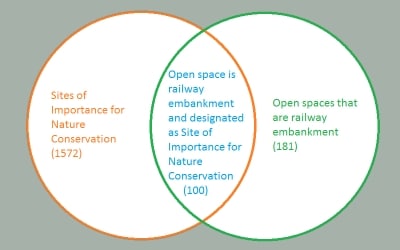
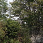
- Venn Diagram of SINC status and railway embankment
-

- Battersea Park © Reimagine London Project
-
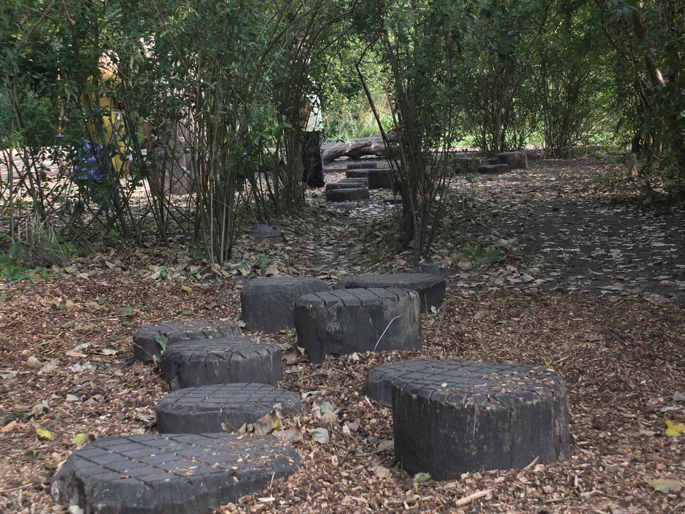
- Morden Hall Park © Reimagine London Project
-
- Merton @ Reimagine London Project
-
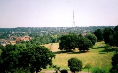
- Norwood Park (c) Mathew Frith
-
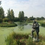
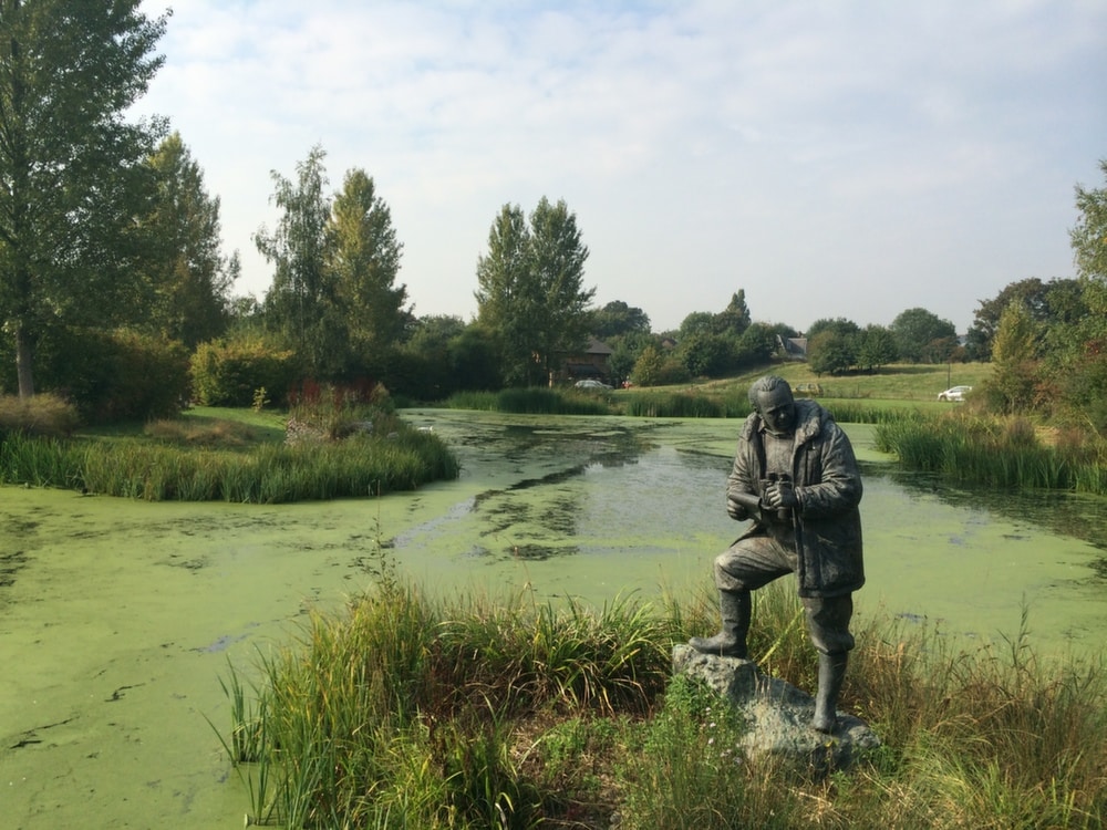
- London Wetland Centre © Reimagine London Project
Reimagine London is a photographic journey to reimagine Greater London as the world’s first National Park City. It is a collaboration between the School of Geography at Queen Mary University of London and the Greater London National Park. The project was designed to encourage first year undergraduate geography students to explore and engage with London in creative, imaginative and practical ways at the very start of their studies; opening them up to new ways of thinking about the city and the ideas that are at the heart of this initiative. The project has been funded by the Westfield Trust and Queen Mary University of London.
The project started in September with 132 geography students exploring all of the capital’s 32 boroughs and the City of London. They were challenged to discover new parts of the capital and take photographs while reimagining London as a national park.
The proposed purpose of a Greater London National Park is similar to other UK National Parks. It would conserve and enhance our natural and cultural heritage, promote opportunities for the understanding and enjoyment of London’s green spaces, and foster the economic and social well-being of local communities. The geography students were challenged to take pictures that showed London’s green spaces, nature and wildlife, its opportunities for recreation and wellbeing, and finally its distinctive urban landscape. In all they submitted 1,584 photographs.
While some students took photos that revealed some of the capital’s best architecture and green infrastructure, others observed the harsh realities of forgotten and sometimes neglected spaces.
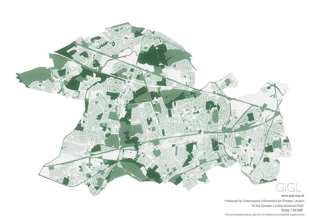
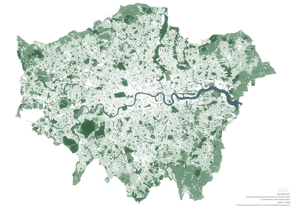
The images themselves were displayed in a photographic exhibition at Queen Mary University London and at City Hall during October. The exhibition will be on show again at the Southbank Centre as part of a Reimaging London: What if we made London a National Park? event on 24 February 2015. The exhibition is made up of the photographs and a series of beautiful maps created by GiGL. The maps reveal the green and open spaces of London, parks, woodlands and millions of private gardens. Using Ordnance Survey and GiGL data, one large map shows an overview of London which is then followed by 33 maps across 33 posters for each of the 32 boroughs and the City of London.
You can contribute to the project by tweeting pictures that re-imagine London as a National Park using the hashtag #ReimagineLondon, to @ReimagineLondon and to @Reimagine.London. For more details, or to support the Greater London National Park initiative, visit www.GreaterLondonNationalPark.org.uk.
Daniel Raven-Ellison is a Guerrilla Geographer and National Geographic Emerging Explorer. He is one of the authors behind Mission:Explore, a series of geography challenges for children, and more recently is campaigning to make London the world’s first National Park City. You can connect with him on Twitter at @DanRavenEllison.
GiGL Perspective
There is nothing quite like a good map. We’ve been delighted with the positive response to those we made for the Reimagine London project. The maps were picked up by The Independent and by BuzzFeed UK which meant a lot of people had access to high quality maps showing London’s green and open spaces and gardens. People are always amazed when they realise how green London is and plenty of comments reflected this as the maps were shared on social media. It’s lovely when others get as excited as we do about the diverse landscapes of London.