Biodiversity Hotspots for Planning
GiGL’s Biodiversity Hotspots for Planning (BHP) layer provides indicative areas of biodiversity hotspots in Greater London, identified by research and data analysis using methods derived from the Greater London Authority’s (GLA) “Planning for Biodiversity?” report (2016).
Research for this dataset has been assisted by London and South East England Local Records Centres (LaSER) and the London Boroughs Biodiversity Forum (LBBF), and is based on advice provided by the Open Data Institute (ODI).
To meet Policy G6 D of The London Plan (2021), the capital’s spatial development strategy, “Development proposals should manage impacts on biodiversity and aim to secure net biodiversity gain. This should be informed by the best available ecological information and addressed from the start of the development process”.
The BHP dataset provides developers, homeowners and LPAs an indication of areas, where data are available, that have potential impacts on biodiversity and are likely to be relevant to local planning decisions by applying biodiversity criteria developed by GiGL, based on the original “Planning for Biodiversity?” research. ‘Hotspot’ areas indicate a detected presence of sensitive biodiversity that could potentially be affected by development. Original records can be accessed from GiGL to assist the decision-making process.
Please note, areas without these biodiversity indicator records may still have undetected biodiversity so should also be considered for biodiversity potential on a case-by-case basis. The dataset is purely indicative and an ecological data search report must still be commissioned as evidence for planning applications. See here for more information on this.
Specification
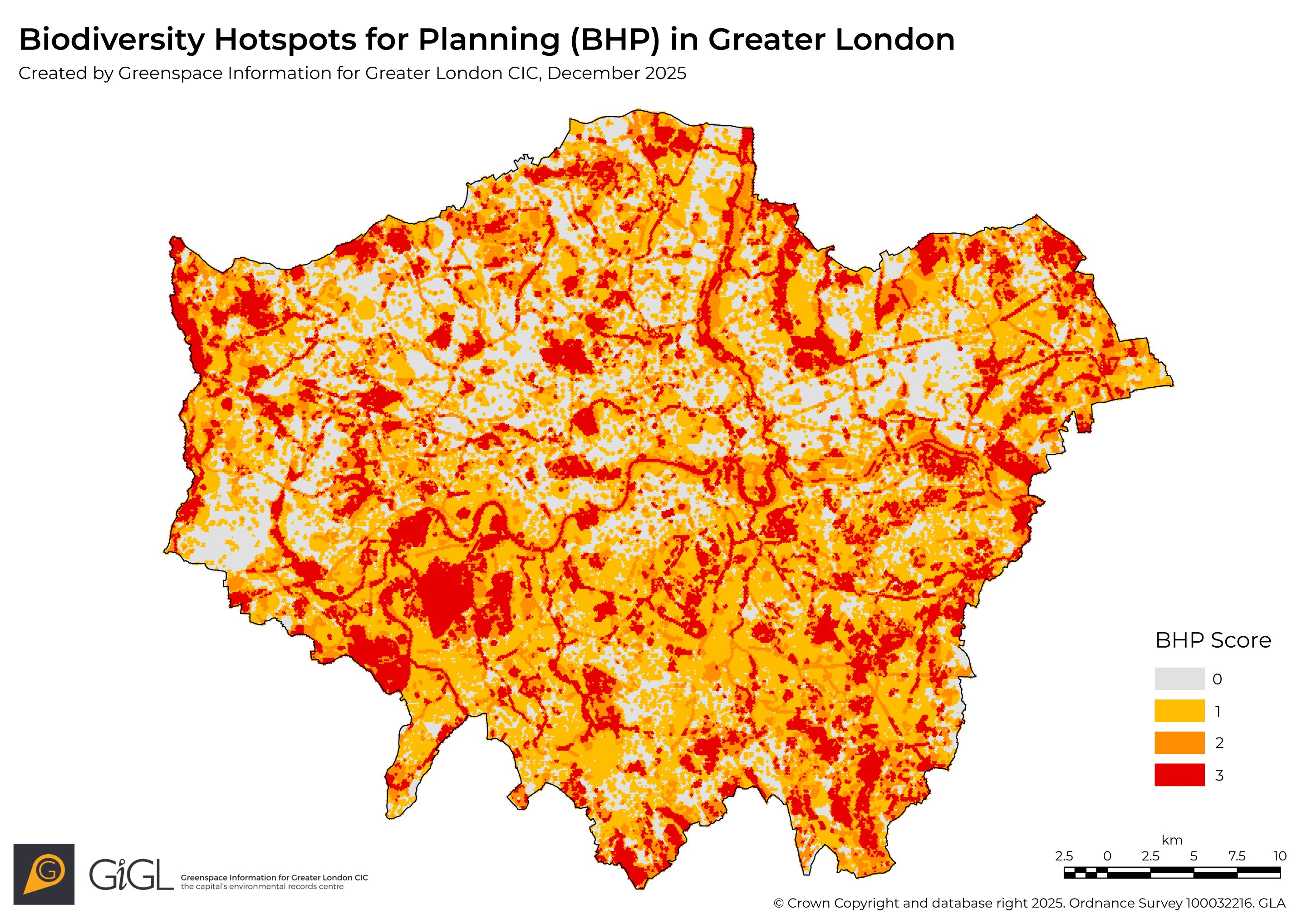
The BHP layer shows London as 100m hexagon tiles. Each tile is scored for the known presence of protected species, sites and habitats impact areas based on the impact buffer size as specified in the criteria table below, giving a cumulative score range of 0 to 3. Tiles are considered a hotspot where impact areas overlap the tile by more than 10%.
Tiles with a score of 0 indicate that there are currently no known protected species, sites or habitats impact areas present in that area based on the criteria table, which excludes some protected species. Tiles with a score of 3 indicate the presence of impact areas for all three categories. Intermediate scores indicate the presence of impact areas for one or more of the categories without specifying which are present. The scores can be used in a thematic map to colour the tiles and visually indicate areas with greater presence of impact areas.

Access
The BHP layer is an open dataset available for download on the London Datastore. The layer is also viewable on GiGL’s Discover London portal and is sent to GiGL partners each data exchange.
The dataset is updated annually, every November, using the latest protected species, sites and habitats data available to GiGL at time of creation. Please give GiGL appropriate credit when using, adapting or sharing the dataset following the guidance on the London Datastore.