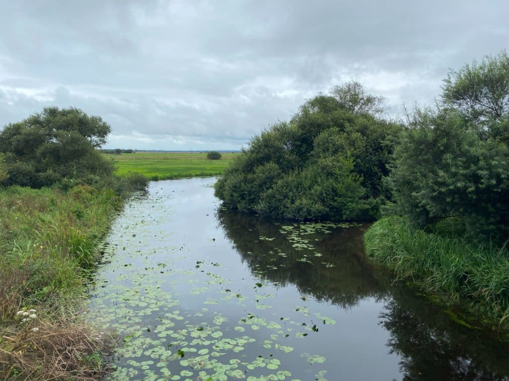
Excluding the Thames, Greater London is home to over 600 km of rivers and streams flowing through 11 main catchments. Our rivers create special places for Londoners, helping us to reconnect with nature. They also support nature’s recovery and rewilding, and help to improve flood resilience and our ability to adapt to climate change.
Sadly, many of our rivers aren’t in great shape. A long history of neglect, modification and ongoing pollution, to name just a few challenges, means they’re unable to realise their full potential in delivering those vital benefits.
River restoration
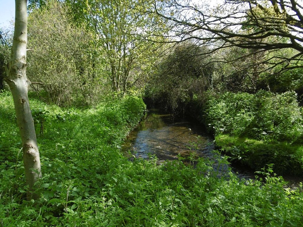
The good news is that there are lots of opportunities to restore and rewild our waterways. River restoration is all about reviving natural processes, and it can happen in a variety of ways and at different scales.
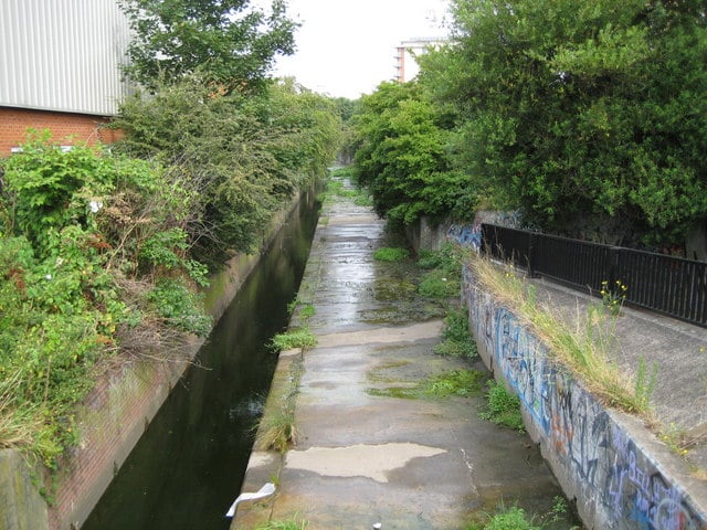
This can be improving a river channel by removing hard engineering and creating natural banks, reintroducing meanders to straightened channels or removing sluices and weirs to create more natural river flows, or even reclaiming ‘lost’ rivers that have been buried underground.
Identifying suitable locations for action is an important first step in restoring London’s rivers. The River Restoration Opportunity Map (RRO) aims to do just that.
River Restoration Opportunity (RRO) map
Led by the Environment Agency in partnership with GiGL, Zoological Society of London (ZSL), Thames21 (T21) and the River Partnerships in London (RiPL), with support from a steering group, an interactive online map has been made to bring together river restoration opportunities across London. The map includes projects that aim to restore rivers and streams, excluding canals, covering actions such as reconnecting rivers to floodplains, improving river habitats, creating wetlands, and more.
How to use:
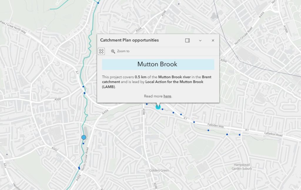
- Light blue circles on the map show opportunities from Catchment Plans, collated by ZSL from catchment partnerships in spring 2024.
- The size of the circle shows how much river length the project covers and you can find out more by clicking each one.
- The dark blue circles are projects from the EA’s Catchment Planning System, collated from catchment leads in September-October 2024. These tend to be more aspirational but also include mitigation measures such as fish passes and invasive species control. There may be some overlap between the two types of point, but the aim is for all to be included within catchment plans in time.
- You can also view completed projects, shown as red stars on the map.
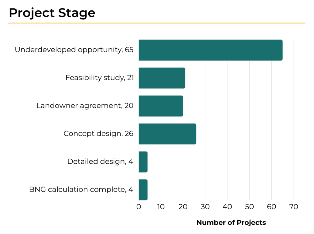
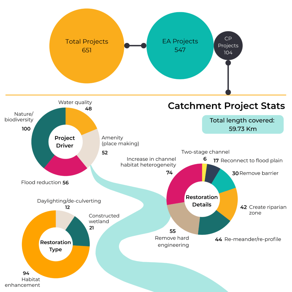
There are 651 opportunities in total, with 104 from Catchment Plans and 547 from the Environment Agency planning system. The Catchment plans alone include a potential 60 km of river restoration. To put that in perspective, a 2020 report published by Catchment Partnerships in London showed that between 2000-2019, around 39 km of river was restored across 111 projects. That’s an amazing amount of work already done, but it also shows the incredible potential shown on the map.
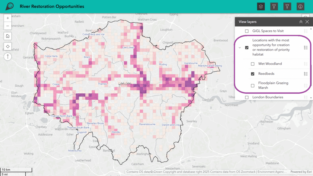
Also included on the map is a version of GiGL’s Habitat Suitability Modelling for three wetland priority habitats: Wet Woodland, Floodplain Grazing Marsh and Reedbeds. These grid datasets show the amount of opportunity for the creation or restoration of those habitats, using the latest ecological and geomorphology data such as soil types, water characteristics and current habitat.
Alongside the map, an interactive StoryMap has also been produced to help guide users through the project. Included in this are some amazing case studies of the kind of work taking place, such as Butter Mill on the River Wandle, where barriers to fish migration have been removed and debris added to increase variation in flow and habitat types, and Rewilding the Rom, where the river has been reconnected to the floodplain to restore natural function.
It is important to note that while this is an important subset of river opportunities, there is a large amount of work going on at the catchment partnership level, and some of these projects are linked to within the StoryMap. Just one example is the London River Health map which highlights different datasets centred around river health, such as pollution sources and SuDS sites.
Uses of the map
The map is intended to be of use in both planning and strategy decisions, as well as community engagement.
On the planning side of things, the map will feed into the following projects:
- GiGL Data Search reports: River opportunity will now be included in GiGl’s Data Search Reports. These reports are the go-to resource of information on London’s natural environment, and contain information on designated sites, species, habitats, open spaces and other important features. Used by developers and their contractors, these groups will be able to see opportunities within or near to their projects so they can take inspiration, and potentially offer complementary enhancements, or contribute directly, either financially or with delivery. It’ll enable developers and their consultants to make informed decisions when considering Biodiversity Net Gain (BNG) & catchment plan delivery.
- The Mayor’s Clean and Healthy Rivers Plan: The opportunities will also be used to help carry out analysis for the GLA’s Clean and Healthy Waterways Plan & River Health map, which aims to improve London’s waterways. For example, the points can be used together with social and environmental data to identify priority areas for investment and improvement.
- London’s Local Nature Recovery Strategy (LNRS): A new system of spatial biodiversity strategies in England, with the aim to identify areas where nature recovery should be prioritised. All RROs were included in an initial longlist of locations to consider for Potential Measures, which were then screened against priorities for London.
For community engagement, we hope that the map will be used by community groups and members of the public to see what’s being planned and implemented in their local area and wider catchment. It’ll allow anyone to explore a whole host of different projects that they can get involved in, support or share resources with.
Seeing projects that are already underway or complete can also act as inspiration for new initiatives and help identify potential gaps across the wider catchment.
As for the projects on the map, it’ll help to raise awareness by giving them a London wide platform.
To find out more about any of the projects please contact the catchment partnership, which can be found via the following link: www.thames21.org.uk/catchment-partnerships. If you have a project idea for a river or stream or think something’s missing, please submit this to your local catchment partnership. Newly identified opportunities will feed into the RRO map and will be updated over time.
We need our rivers more than ever, to tackle climate change, support biodiversity, and improve quality of life for all Londoners. We encourage everyone to take a look at the map and StoryMap to explore what’s happening near you.