Julie Cox, GiGL Data Officer
There’s nothing quite like seeing your work in print. It feels even better when it’s correctly attributed to you.
As part of our function as Greater London’s environmental data hub we often get asked for facts, figures and illustrations relating to the capital’s wildlife or open spaces. These range from statistics to support our partners’ day-to-day work, to tailored maps for specific one-off projects.
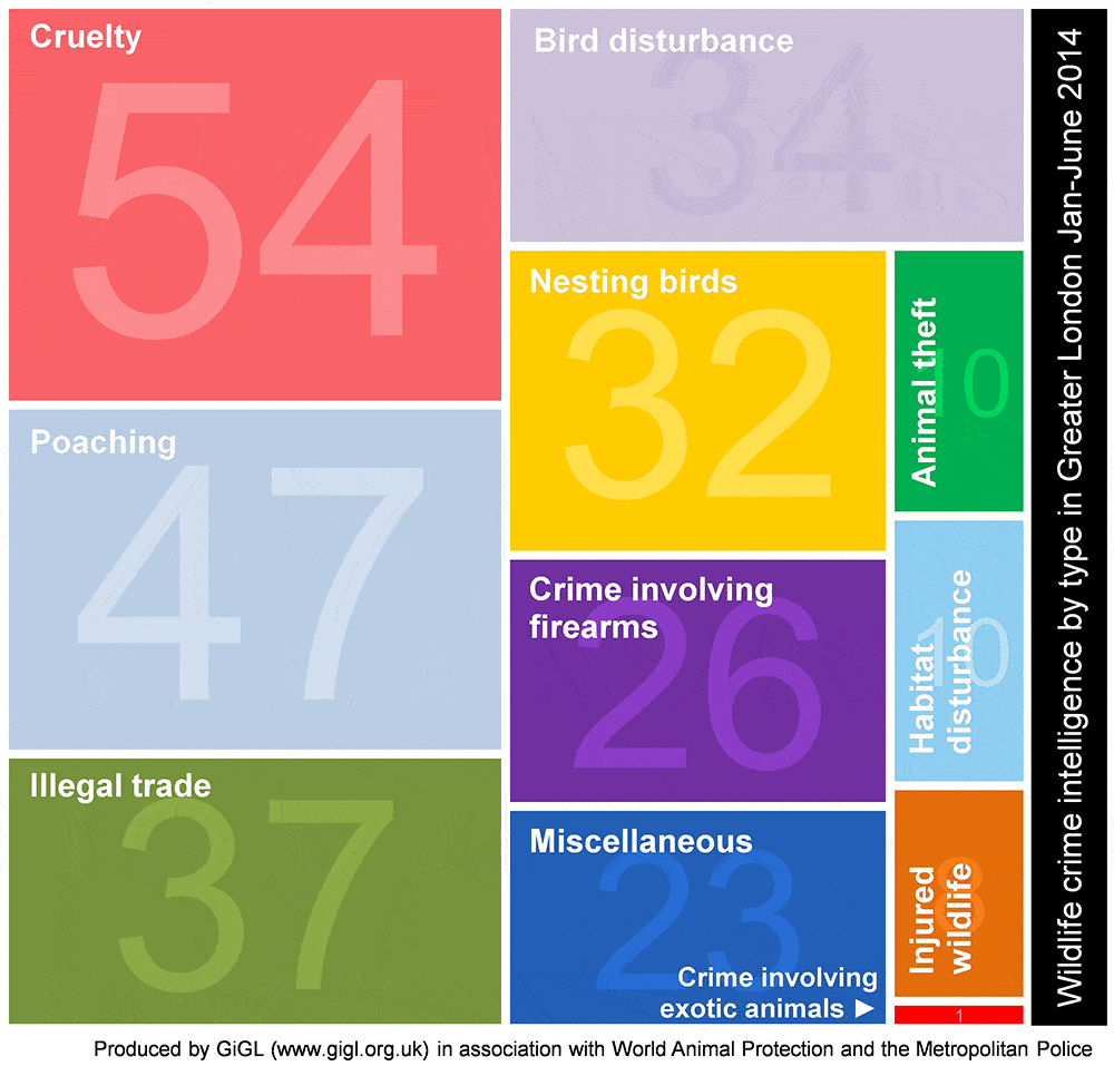
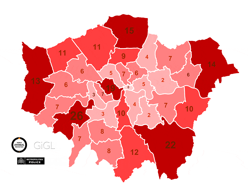
Over the last year, we’ve supported our partners with a range of numerical facts, figures and visualisations. Some of these have received widespread coverage, both on social media and in the printed press. One example is our work on the Reimagine London project for which one of our maps had a staring role in the Independent. We’ve also been instrumental in helping World Animal Protection to raise awareness of wildlife crime in London. As well as interactive maps, we produced infographics showing wildlife crime statistics which were used during World Animals Protection’s publicity campaigns.
Facts and figures are not only important for publicity. At the beginning of the year, the London Assembly Planning Committee met to debate issues concerning the protection of London’s green and open spaces. GiGL was able to provide statistics to inform the discussions.
In response to requests like these from our partners and other interested parties, we’ve created a new page on our website which provides key figures for London. This includes answers to commonly asked questions such as: “How green is London?”; “How much of London is designated for nature conservation?” and; “What is London’s open space used for?”
Below are a few simple rules to ensure GiGL is adequately acknowledged:
Although we often use our acronym “GiGL”, in the first instance in any report it’s important to use our full title of “Greenspace Information for Greater London CIC”. GiGL is fine for second and further use in a report or article.
It’s great if you can quote our website www.gigl.org.uk so that readers can easily find out more about us and request further information if necessary.
Where a map displays predominantly GiGL data, our logo should be included. This can be downloaded here.
Where a map shows GiGL data, we request that the following statement is included in the map credits; “map displays GiGL data, 2014”.
Where a map shows information derived from GiGL data, we request that the following statement is included in the map credits; “map derived from GiGL data, 2014”.
Remember that a lot of GiGL datasets are based upon Ordnance Survey data and so a valid Ordnance Survey licence number should be included in map credits in many instances. If you’re unsure about this we’re happy to advise.
And finally, our data licences prohibit publication of GiGL data in its raw form. Publication of interpreted information is allowed in some circumstances but please contact us prior to release.
Julie Cox is one of GiGL’s Data Officers. With a background in ecological conservation she greatly enjoys seeing GiGL provided statistics used to support conservation work in London. Having produced the open space maps for the Reimagining London project, she was thrilled to see one staring on the centre fold of the Independent’s i newspaper.