Crayford Marshes are one of the few remaining examples of extensive grazing marsh in London. Here we find a large expanse of seasonally-damp pastures, subdivided by water-filled ditches with stands of reeds, and occasional hedgerows of native species. There are also some saltmarshes at the fringes adjacent to those within the River Thames Metropolitan site. The site also includes several buildings of historic and archaeological interest, including the ruins at Howbury Moat (dating from 11th century) and the Tithe Barn (1600s). In the same area are some of the oldest trees on Crayford Marsh, believed to be around 300 years old.The Marshes are currently being considered by Natural England as a possible Site of Special Scientific Interest.
Local Wildlife Site
Accessible Sites of Importance for Nature Conservation
Crayford Marshes
Borough: Bexley
Grade: Metropolitan
Access: Access on public footpaths only
Area: 92.71 ha
Description
Wildlife
The plant life of the ditch network, flooded pasture and saltings is diverse, and includes several national and regionally uncommon species. Amongst these are brookweed, marsh and sea arrow-grasses, brackish water-crowfoot and divided sedge. Dry grassland on the sea-wall is also of interest, with further rare plants to be found including knotted hedge-parsley and corn parsley.The site's bird life is equally important. At low tide the mudflats on the Thames are exposed providing a rich feeding ground for wading birds. Some of these are therefore attracted to breed on the site including redshank and lapwing. Other breeding birds are yellow wagtail, skylark and corn bunting; those regularly spending the winter on the site include wildfowl and further waders, short-eared owl and hen harrier, as well as large flocks of finches and thrushes.The aquatic insect life of the ditches is also exceptional, with many nationally rare species including Duffey's bell-head spider and the hornet robber-fly.An important population of water voles is present in the ditches.Facilities
Cycle paths. The London LOOP follows the Thames and Darent Embankments along the northern and eastern edges of the marshes.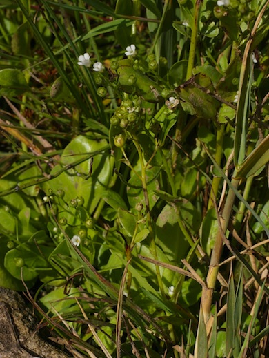
Brookweed © Mike Waite
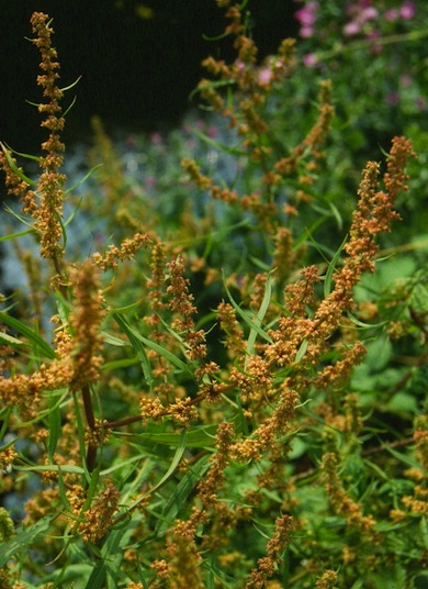
Marsh dock © Mike Waite
Feedback
Have a question or a comment for this site, or notice anything missing or out of date? Please contact us.