In this article we would like to (re-)introduce you to GiGL’s data search report service and provide some information about why they are so important in the planning process. We are also very pleased to launch a new interactive map on our website that showcases report numbers and planning applications for each local authority.

Nature conservation is a material consideration in the planning process, which means that nature should be taken into account when deciding a planning application or in an appeal against a planning decision. There are several policies and legislation in place for the protection of sites, habitats and species.
| The National Planning Policy Framework (NPPF) includes: 174. Planning policies and decisions should contribute to and enhance the natural and local environment by: a) protecting and enhancing valued landscapes, sites of biodiversity or geological value and soils (in a manner commensurate with their statutory status or identified quality in the development plan); d) minimising impacts on and providing net gains for biodiversity, including by establishing coherent ecological networks that are more resilient to current and future pressures; 180. When determining planning applications, local planning authorities should apply the following principles: a) if significant harm to biodiversity resulting from a development cannot be avoided (through locating on an alternative site with less harmful impacts), adequately mitigated, or, as a last resort, compensated for, then planning permission should be refused; |
When a development has the potential to harm nature, appropriate impact assessments should be undertaken by a qualified professional ecologist. These assessments are submitted to the Local Planning Authorities in the form of ecology reports (e.g. Preliminary Ecological Appraisals) along with other documents of a planning application. According to best practice professional standards set by the Chartered Institute of Ecology and Environmental Management (CIEEM), a desktop study should be part of ecological reports and it should include[1] information from a data search report from the Local Environmental Records Centre (LERC) which for London is GiGL.
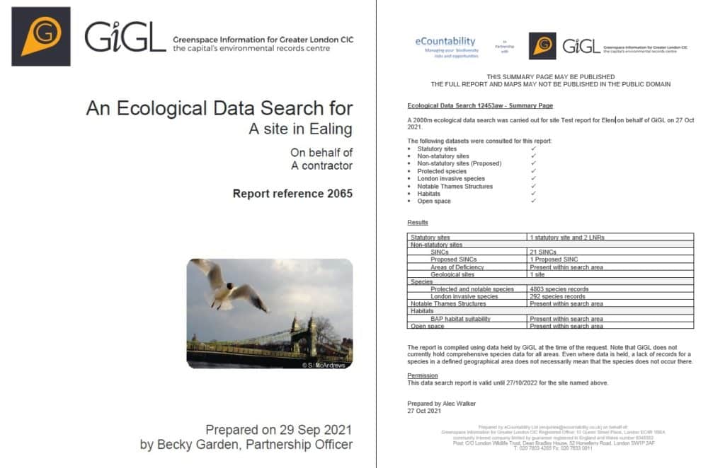
GiGL’s data search reports provide information on the existing evidence base and context for the site, both important elements for assessing the potential ecological impact of a development project. Delivered on our behalf by eCountability, they include information on species, habitats, open spaces and statutory and non-statutory sites (including adopted and proposed Sites of Importance for Nature Conservation, SINCs). The area of coverage is usually one or two kilometres radius from the proposed development site and the reports are valid for one year.
These data search reports cannot be submitted with a planning application but the summary sheet can be submitted to provide proof that a data search report was indeed commissioned. The summary sheet provides information on when the data search report was obtained and a summary of the important information that was found within the specified radius (e.g. 21 SINCs).

In 2016, a project by the Mayor of London concluded that about 18% of planning applications in a one year period in London should have been supported by a biodiversity data search, based on a set of criteria used to assess the potential impacts of the proposed developments on biodiversity. These criteria include the presence of protected and priority species, designated sites (statutory and non-statutory) and priority habitats. The results of the project showed that only 1% of applications that were validated were informed by a GiGL data search during the same period. GiGL later developed the Biodiversity Hotspots for Planning layer based on the criteria of this project.

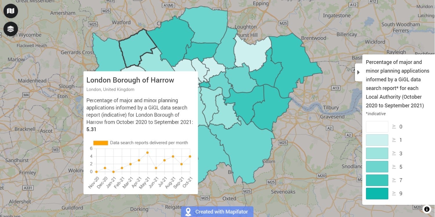
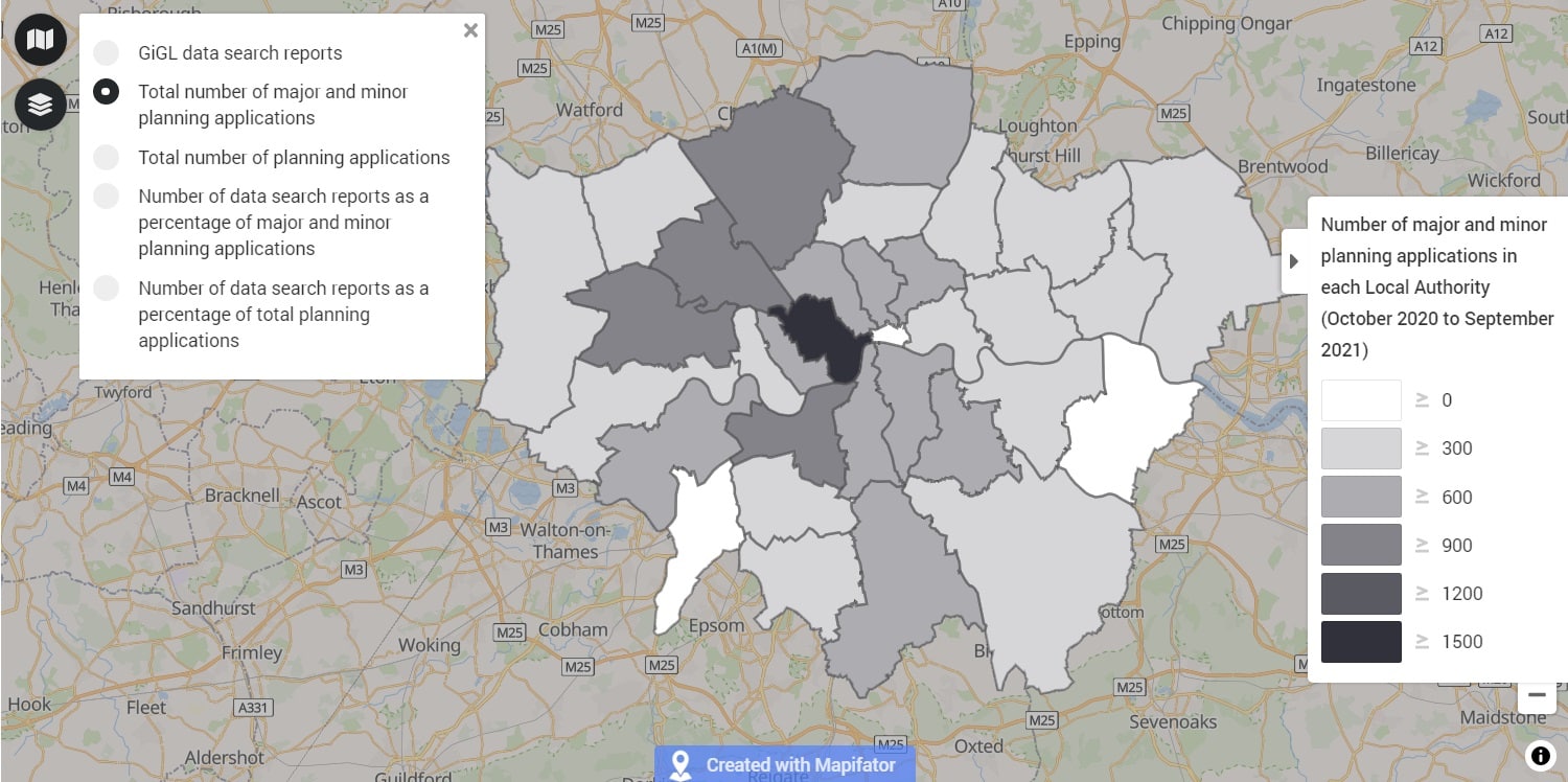
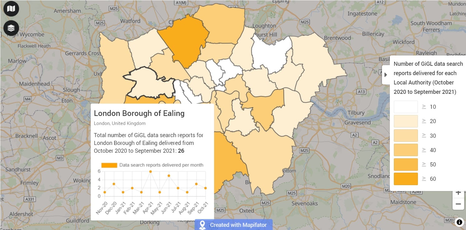
GiGL has been providing annual figures of data search reports for each Local Planning Authority (LPA) together with other relevant figures (i.e. number of planning applications and percentage of planning applications with data searches) on our website for a few years now. However, we wanted to make these figures more accessible, informative and helpful to our partners, members of the public and other stakeholders. We are therefore very happy to launch a new interactive map which presents all the above information and more in a more visual and accessible form. There are five layers presenting different data and pop up boxes which include monthly data search numbers for each LPA.
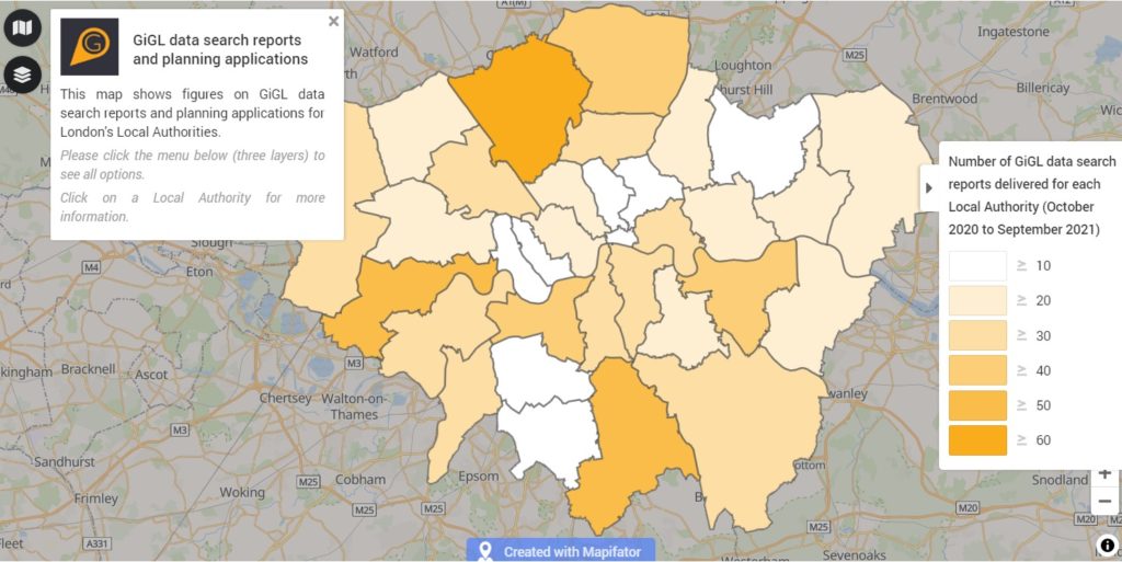
We are hoping that this information can be used by various stakeholders. For example, LPAs can check the number of data search reports delivered to ecological consultants for their area. They can also check how they are faring compared to other LPAs and to the desirable 18% that was identified by the research mentioned above. Members of the public can also use the information to encourage their LPA to do better when it comes to evidence based decision making and achieving better outcomes for biodiversity.
The LPAs that are GiGL’s SLA partners have access to the same evidence base that underpin the data search reports provided to our clients. It is very important that this evidence base is also used by the LPAs when considering the potential impacts of a development project, and if potential ecological impacts are identified they should ensure that information from GiGL’s data search reports have been taken into account. The importance of using the correct evidence base and planning for better biodiversity outcomes cannot be overstated, and you can read more on this topic in previous GiGLer articles (here and here), and on our website page here.
As a Community Interest Company (CIC) we give great emphasis to the support we provide to community groups and members of the public. If they think appropriate consideration of ecological matters has not been given, community members can also access a version of our data search report tailored specifically for them.
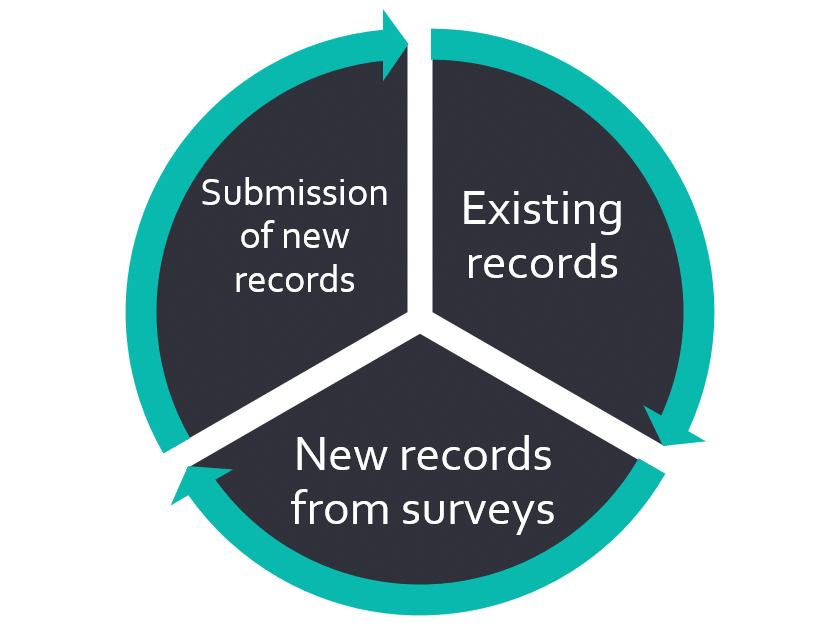
To close the loop it is important that data throughout the development management process are shared with GiGL in order to inform future development projects. The importance of sharing data was highlighted at London Recorder’s Day 2021 by Katie Boyles who spoke about her story at Warren Farm. Katie works as part of a dedicated team of volunteers to record all species found at the 61 acre site, both common and rare, to build a solid base of evidence showing its ecological value, helping to protect the site. You can read more about her work in her GiGLer article here. It is also important to note (and is also evident in Katie’s experience at Warren Farm) that when biodiversity data are not available for an area, this does not necessarily mean that there is no biodiversity present. It might just mean that no one has recorded it. Wildlife recording and data sharing along with appropriate ecological expertise in LPAs and in developers’ teams is therefore very important.
| ‘Closing the loop’ is in line with the recently published Geospatial Commission’s report “Mapping the Species Data Pathway: Connecting species data flows in England” (2021) and specifically recommendations 12 and 13 on data use: 12. Mandate the re-use of species data collected by consultants in transparent processes that support regulatory compliance, potentially through new regulation. This will reduce survey costs, improve professional standards and support environmental outcomes. 13. Require proponents of development to certify that best available species data through the BDF have been accessed in the preparation of applications where there is risk of impact on biodiversity, potentially through new regulation. This will help ensure that existing and newly collected species data is equally available to project proponents, regulators and evaluators and will support environmental outcomes. |
With the Environment Act and the new requirements for Biodiversity Net Gain and Local Nature Recovery Strategies, as well as the climate and ecological emergencies, it is more important than ever that decision making is based on a robust evidence base. The development management process needs to be informed by this evidence base and take appropriate account of biodiversity in order to comply with the relevant policies and legislation and achieve better outcomes for biodiversity.
Consultants can order a data search report via our partner eCountability here. GiGL SLA partners can contact one of GiGL’s Partnership Officers to request in-house data search reports or other information, while community groups can contact Community Officer Ben Town to request community data search reports.
[1] There are very few exceptions to this. For more details see Appendix 2 of Guidelines for Preliminary Ecological Appraisal, Second edition (2017)