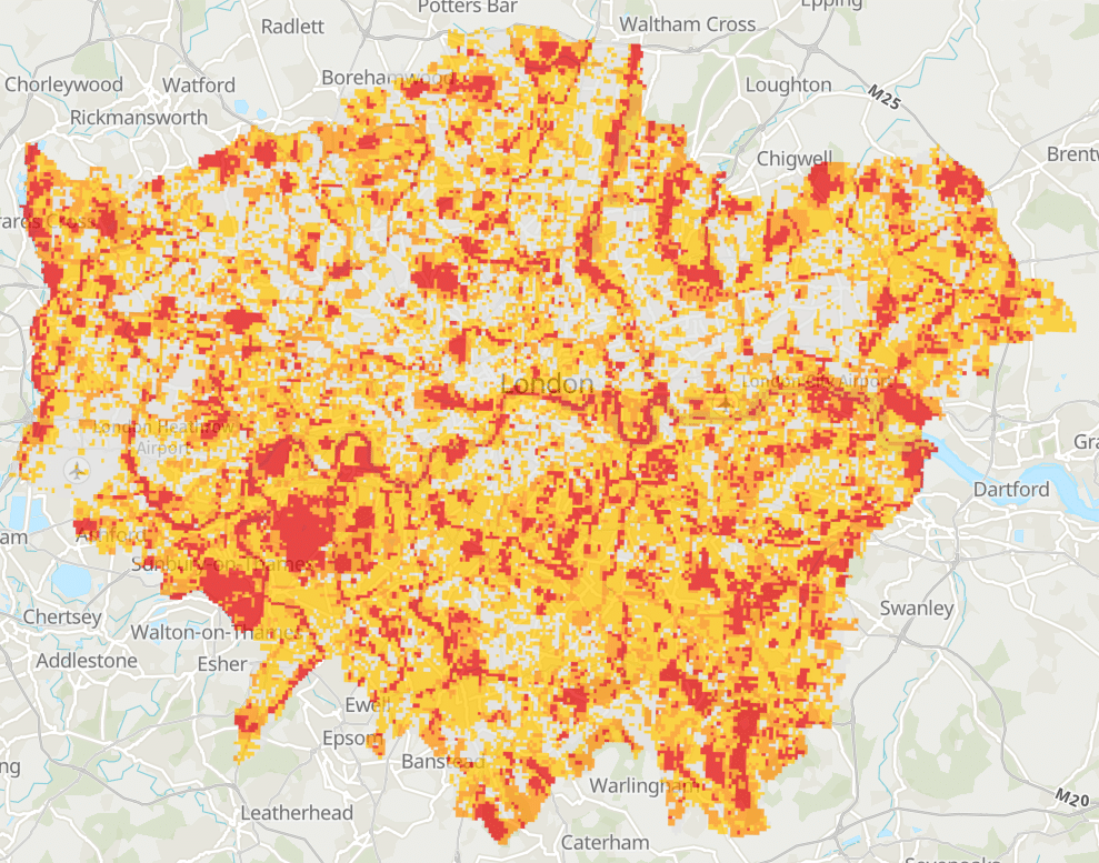
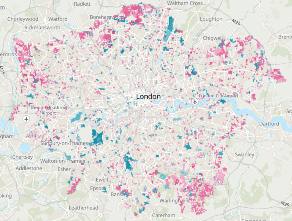
After the re-launch of our online mapping platform, DiscoverLondon, last year, we are pleased to say we have now released some new datasets on to the platform. These are our open-source Biodiversity Hotspots for Planning (BHP) layer and our Woodland Opportunity layers produced from a recent TCAF-funded project.


Contains OS data © Crown Copyright and database right 2023. Contains data from OS Zoomstack
The BHP layer shows London as 100m hexagon tiles. Each tile is scored for the known presence of protected species, sites and habitats, giving a cumulative score range of 0 to 3. Tiles with a score of 0 indicate that there are currently no known protected species, sites or habitat impact areas present in that area. Tiles with a score of 3 indicate the presence of impact areas for all three categories. The scores are displayed in a graded hexagon grid to visually indicate those areas with a greater presence of impact areas. The BHP dataset provides developers, homeowners and LPAs an indication of areas, where data are available, that have potential impacts on biodiversity and are likely to be relevant to local planning decisions. The layer has been an open dataset for many years and is available for download on the London Datastore. Now that we have released the map on DiscoverLondon too, it can be viewed without the need for GIS software. The dataset is updated annually, every November, using the latest protected species, sites and habitats data available to GiGL at time of creation.
Over the last few months, GiGL have been modelling potential woodland creation areas in Greater London. Our comprehensive methodology can be read in detail here. The Woodland Opportunity layers now available on DiscoverLondon are the product of this modelling, presented as hexagon grids. Two layers are present, one showing woodland creation potential and the other showing the opportunity to create woodland features, e.g. hedgerows or scattered trees, which may aid woodland connectivity. Both layers are scored from -1 to 6, where -1 is an area better suited to the creation of an alternative type of habitat, and 6 is an area with the greatest potential for woodland creation. The map can be used as a guide for planning new woodland creation projects.
These new layers join existing data on wildlife crime, spaces to visit, wildlife sites, rivers and waterbodies, recording support and London’s landscape to make DiscoverLondon a valuable portal for investigating the city’s natural surroundings.
