From 2021 to 2024, GiGL led a research project to improve the accuracy of records of London’s ancient woodlands, helping to ensure these nationally important habitats are properly represented. GiGL managed the project and recruited a dedicated Ancient Woodland Inventory Project Officer, Frankie, who led the research and verification work. The project focused on updating Natural England’s Ancient Woodland Inventory (AWI), which was first produced in the 1980s, before the advent of modern mapping technology, and therefore inevitably contained errors and omissions. Particularly, small sites under two hectares, as well as ancient wood pasture and parkland sites, had previously been underrepresented in London.
The project gathered comprehensive evidence of woodland longevity, drawing on sources such as historic maps and field surveys with the help of a dedicated team of volunteers and a project-specific survey team, to expand and update the existing dataset. This article outlines the importance of the update project, briefly explains the work carried out at each project phase and highlights case studies of key sites which have benefitted from correct classification and protection within the updated Ancient Woodland Inventory.
AWI update by numbers:
- 7,000 500m grid squares examined
- 253 land parcels surveyed across 16 London boroughs
- 2,500 hectares of previously unrecorded ancient woodland identified
Result: Greater London’s recorded ancient woodland area increased by 78%!
What are ancient woodlands and why are they important?
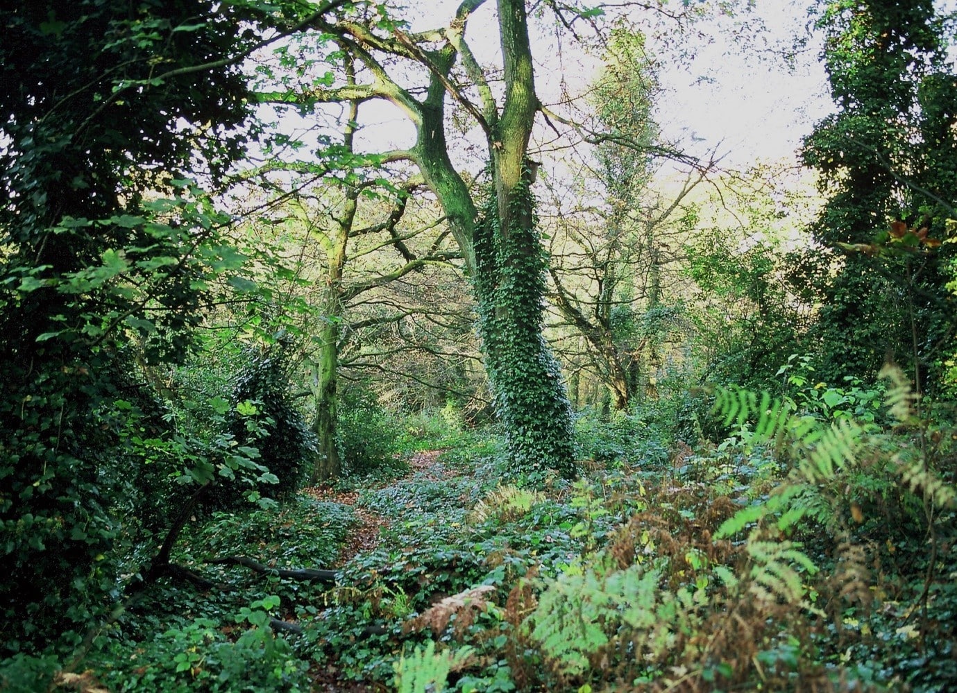
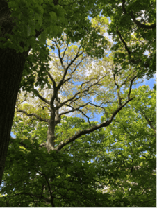
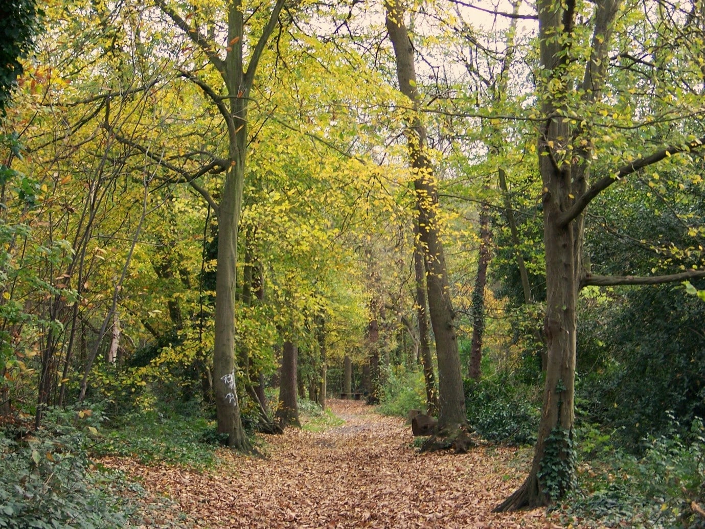
Sydenham Hill Woods, a London ancient woodland site. © London Wildlife Trust
Ancient woodlands are classed as areas that have been continuously wooded since at least 1600 AD. The longevity of these sites and the relatively undisturbed soils they contain allow them to support a diverse range of important flora and fauna species. Ancient woodland sites are irreplaceable: once lost, they cannot be recreated. The importance of these habitats is pronounced in predominantly urban areas such as Greater London, where they provide a key recreational and educational resource whilst also acting as havens of biodiversity amongst the heavily built-up landscape.
Ancient woodland is a protected habitat type both nationally and regionally, across a variety of planning acts and frameworks. For example, the London Plan states under Policy G7 that all London boroughs are required to protect ancient woodland as part of their Development Plans.
Despite existing protections, many ancient woodlands have suffered damage or been permanently lost due to development practices. It is important that the location of ancient woodlands is accurately known to ensure their adequate management and protection. This is especially important in Greater London, where intense development pressure makes it vital that the city’s remaining ancient woodlands are given proper protection. Furthermore, the AWI update introduces the opportunity to use the dataset to support the sustainable management and restoration of ancient woodlands, by helping focus future tree establishment efforts that buffer and connect fragments, whilst also contributing to landscape-scale plans such as Nature Recovery Networks.
Project benefits and drivers
GiGL’s project to update the AWI helped to guarantee that these stakeholders have the evidence they need to fulfil planning policy duties and properly protect ancient woodlands whilst ensuring increased confidence in the inventory. This is important for accurate data records as the AWI is used as a reference tool for planners, developers, policymakers, landowners, and conservationists.
Importantly, small sites between 0.25 and 2 hectares which were previously omitted from the inventory are now included. This is of significance in London, where small sites represent a key component of the city’s wooded landscape. The addition of wood-pasture and parkland habitat types into the updated AWI has assisted in many major London parks being considered for inclusion in the inventory for the first time, allowing more qualifying sites to benefit from the protection afforded to ancient woodland habitats.
Ancient Wood Pasture and Parkland (AWPP):
A mosaic habitat comprising of open grown veteran trees. This habitat might exist in tandem with a long-established tradition of managing trees and grazing.
Infilled Ancient Wood Pasture and Parkland (IAWPP):
Ancient wood pasture and parkland site which has become infilled with trees due to natural regeneration or from planting, resulting in closed-canopy woodland
The project
The first step of the project involved identifying areas of long-established woodland. These are woodland sites which have been present on historic maps since at least 1893 and could potentially be even older. Identifying long-established woodland involved locating woodlands visible in current-day aerial photographs that are also documented on 1st Edition Ordnance Survey maps dating back to the mid-1800s. During this project phase nearly seven thousand 500m grid squares were examined in total!
Next, evidence was sought to determine whether the long-established woodlands also met the criteria for ancient woodland, through the consideration of further historic maps of London and the surrounding area. The project team visited local archives and libraries across Greater London, seeking historic maps.
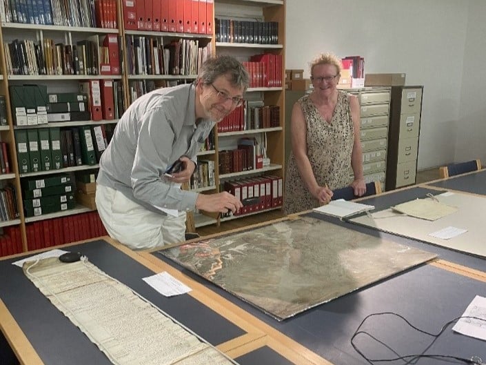
The next step was to georeference many of the maps. This process involves matching known points on the map with their real-world coordinates, so that they can be compared with other spatial datasets through digital mapping software.
An example of Tithe maps from the 1800s covering an area of South-East London, geo-referenced by a project volunteer


Following the desk-based work, evidence from a programme of ground surveys helped to fill gaps where there was insufficient or weak map evidence. The survey programme, which checked sites that possessed features characteristic of ancient woodland, was also used to improve the accuracy or confidence in mapping an ancient woodland site. In total, 16 boroughs were visited, with 253 parcels of land surveyed, these parcels having a mean size of 1.9 hectares. For further detail on the survey programme methodology and the ancient woodland evidencing features looked for during the surveys, see the information within our webpage.
Before submitting the final dataset, all previously gathered evidence was evaluated and the status of each considered site was decided. Due to the large number of sites being considered for both their antiquity and their continuity, this stage of the project was very time-consuming and GiGL are thankful to Natural England for their help.
Once checked as thoroughly as possible within the available time, the final updated AWI dataset was sent to Natural England, ready for review.
The AWI Project volunteers:
The initial phases of the project were greatly aided by the AWI volunteer team, who contributed an impressive 760 hours to the project. They assisted by gathering evidence of a site’s history, including georeferencing the maps they found. GiGL is extremely grateful for all their valuable assistance. You can find out more about their involvement in our previous GiGLer article.
Right: Volunteers Stephen and Pamela visiting the Croydon Research Room.
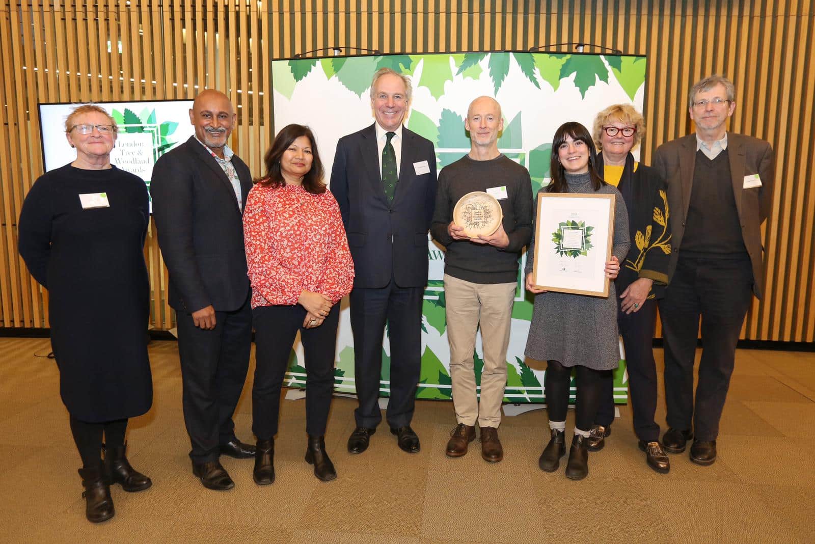
An award-winning project!
The importance of the London AWI update was demonstrated when it was awarded the London Urban Forest Award at the London Tree and Woodland Awards 2023.
Left: AWI Project Officer Frankie, AWI volunteers Pamela & Stephen, and GiGL’s previous Data and Systems Manager, Andy, collecting the award.
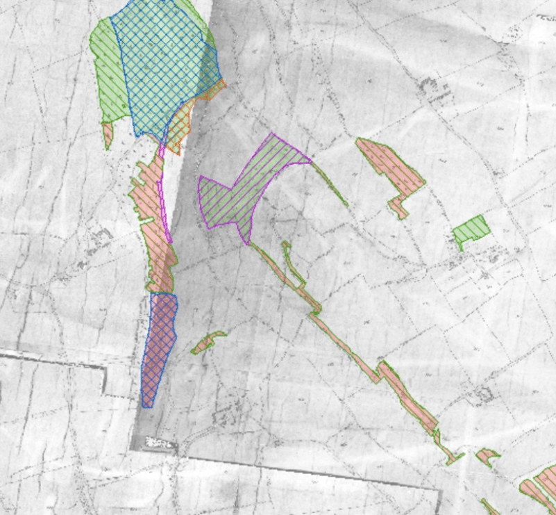
The updated Ancient Woodland Inventory for London
The revised AWI dataset identifies an additional 2,500 hectares of ancient woodland, increasing Greater London’s ancient woodland area by 78%. This is equivalent to over seven Hyde Parks! The map below shows a comparison of the previous AWI dataset on the left and the updated dataset after the project on the right. This addition of sites included within the AWI is a great outcome for the update project and will be central to ensuring the proper protection of these valuable habitats for years to come.


Before and after maps of the AWI update. Contains OS data © Crown Copyright and database right 2026. Contains data from OS Zoomstack.
Most of London’s ancient woodland is around the periphery of the capital, located within the Green Belt, and follows similar patterns in proportional distribution as London’s recent woodland. Oak and hornbeam dominated woodlands are prevalent, with beech woodland emerging notably on chalk soils in the South-East of the county.
Relatively recent management practices have influenced the composition of woodland sites in London. Some suspected ancient sites in London no longer contain the characteristic features (i.e. ancient woodland indicator species) associated with ancientness due to their modification over time.
With invasive non-native species (INNS), amenity planting and poor ground flora found at many ancient woodland sites during surveys, it is recommended that condition assessments are carried out, along with restoration support to site managers and owners, to aid those sites which are identified as most in need of targeted management intervention.
Case studies of inventory additions and subtractions
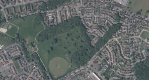
Bluebell Wood, Haringey
Sitting at around 1.2ha, this small site is all that now remains of a once much larger woodland known as Tottenham Wood. Despite being identified as ancient woodland for some time – appearing in literature on Haringey’s ancient woodland back in 1992 – Bluebell Wood had previously been too small to be added to the AWI. The update project has led to the inclusion of this site within the inventory for the first time.
Bluebell Wood is home to a variety of important ancient woodland indicator species, like sessile oak, midland hawthorn and wild service tree. Conservation and monitoring work is carried out at the site by Friends of Bluebell Wood together with a range of partner organisations. Find out more about this and Haringey’s other ancient woodland in this previous GiGLer article.
Bluebell Wood in spring and autumn © Friends of Bluebell Wood
Bluebell Wood, on OS 1st Edition (Epoch 1) map with OS MasterMap boundaries and on modern aerial photography. © Crown Copyright and database rights 2024. Ordnance Survey 100022021. © Getmapping Plc and Bluesky International Limited 2024.
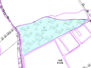
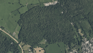
Long Wood and Sage Wood, Havering
Despite being previously flagged as ancient woodland during historic Greater London Authority habitat surveys and standing at larger than two hectares, the site comprising Long Wood and Sage Wood had until now not been officially classified as an area of ancient woodland.
During the project’s survey programme, it was found that the tree canopy is mainly comprised of standard oaks, along with coppiced and uncoppiced hornbeams – two ancient woodland indicator species. Further indicator species were found within the ground flora at the site. Historic evidence also supports the addition of the site to the AWI, with it being present on numerous historic maps as far back as 1633. Now, it has taken its rightful place within the Ancient Woodland Inventory.
Long Wood and Sage Wood on modern aerial photography © Google Maps
The drastic need for proper management of Long Wood and Sage Wood was flagged during the survey programme, with evidence present of human influence and deer browsing. Now that these woods are included within the updated AWI, there will hopefully be further incentive for local conservation groups to turn their attention to the site and ensure its upkeep for the benefit of those who enjoy visiting it and the species it supports.
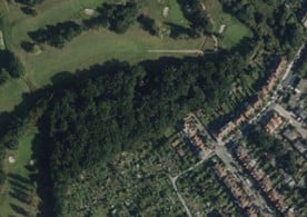
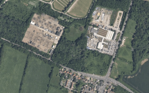
Mad Bess Wood, Hillingdon
Mad Bess Wood on modern aerial photography © Google Maps
The research and study of historic maps during the AWI update project resulted in a south-east extension of the existing ancient woodland site at Mad Bess Wood, thanks to the discovery of features indicative of ancient woodland during the project’s survey programme. Owing to the large span of time that is has been wooded, it is by far one of the most florally rich parts of the woodland.
Jubilee Wood
Jubilee Wood on modern aerial photography © Google Maps
In contrast to the other case studies, Jubilee Wood is an example of a site which was found to be incorrectly included within the inventory! Through the research carried out during the update project, this site is now known to have been planted in 1887 for Queen Victoria’s Golden Jubilee – well after the 1600AD date from which woodland must be present to be considered ancient. As such, the site has been removed from the AWI.
Project next steps
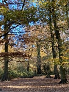
Lesnes Abbey Woods, another ancient woodland site in London. © John Cannell
With the update project complete, GiGL hopes that the new Ancient Woodland Inventory will be of benefit to several groups. The inventory represents an authoritative tool for use within planning and development, to evidence the locations of ancient woodland sites that require consideration during the planning process. It also offers an invaluable resource for community groups wishing to support and defend ancient woodland sites in their local area.
Through this project, the GiGL team and the project volunteers completed work such as the assessment of historic maps for habitat identification, georeferencing of physical documents for use in GIS systems, and the design, facilitation and management of a survey programme. We are well equipped to carry out similar work for our current, or any potential SLA partners. If you think you could benefit from GiGL’s help with any future projects, get in touch with the team via the information on our ‘Contact Us’ page.
The AWI update programme is a multi-partner project with an estimated cost of £3.6 million over 8 years. The project has received funding from Defra, Natural England, Woodland Trust and the Ministry of Housing, Communities and Local Government. 
The work is being carried out across the country by Local Environmental Record Centres and Wildlife Trusts and is being project managed by Natural England. Woodland Trust have played a key role in the delivery of this project, not only through funding but also through project management support and by being part of the team of project board members responsible for steering this important programme of work towards successful completion. The national update of the AWI is also supported by Forestry Commission and The Association of Local Environmental Record Centres.
GiGL would like to thank the following people and organisations for their contributions across the project:
The following organisations for sitting on the project Advisory Group: London Wildlife Trust, Woodland Trust, Greater London Authority, LB Ealing, LB Tower Hamlets, Forestry Commission, Natural England, and Thames Chase Trust.
Members of the London Urban Forest Partnership, London Boroughs, site owners and managers, Local Studies Centre and Archival staff, the Greater London Historic Environment Record, Layers of London and other organisations and individuals that provided support at different points in this project.
Our project volunteers Stephen Bishop, Pamela Harling, Stacie Toovey, Richard Young and Jeremy Nason.
The project survey programme would not have been possible without the support and expertise of our contracted surveyors: Paul Losse and Denis Vickers – Salix Ecology and Georgia Alfreds and Yasmine Airton – Greengage Environmental Ltd.

As well as our volunteer surveyors, Holly Wood, PhD Student Open University, and members of the Bromley Biodiversity Partnership, with special mention to: Dr Judith John, Dr Ishpi Blatchley, Mr Jamie Fletcher, Mr Bob Harrop, Mrs Carol Gould, Mr Steven Lofting.
For more information on the AWI update project, please contact GiGL’s Partnership Officer Louisa Bizzarri (louisa.bizzarri@gigl.org.uk).