By mapping these areas of deficiency, the provision of POS across Greater London can be analysed and open spaces planned and managed accordingly by relevant partners.
GiGL has mapped areas of deficiency to each category of Public Open Space in the hierarchy. These can be combined or analysed separately.
Methodology
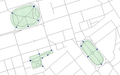
Previously, areas of deficiency have been based on distance as the crow flies. GiGL has developed a new method of accurately mapping areas of deficiency based on actual walking distances along roads and paths. This involves locating access points using information from borough surveys and the Ordnance Survey’s Highways Network information which maps Britain’s road and path network – from motorways to pedestrian streets and alleys.

Process of mapping access points
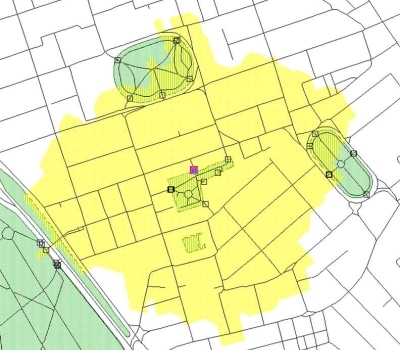
Areas within acceptable distances to Public Open Space are then calculated using a clever piece of “network analysis”. Areas outside of these calculated spaces are classified as areas of deficiency to public open space.

Area of non-deficiency calculated through network analysis
The new model gives a more accurate idea of where areas of deficiency lie than has been available previously. Because it uses London-wide data it is not affected by borough boundaries.
A more detailed methodology is available from GiGL. You can also find out more about AoD from our online newsletter article Knowles Knows series: Areas of Deficiency (AoD).
NB. Areas of Deficiency in Access to Nature are a separate designation.
Map licence: © Crown Copyright and database right 2013. Ordnance Survey 100032216. GLA
