Julie Cox, GiGL Partnership Manager

More London Riverside. Photo by David Iliff. License: CC-BY-SA 3.0
Greater London is endowed with some fantastic public open spaces. However, with over eight million residents enjoying the city’s amenities, as well as the huge influx of tourists for whom our green spaces form part of the lure, the pressure to provide abundant, high quality public spaces is ever present. Traditionally, the provision of publically accessible open spaces has fallen on public authorities. However, as research by The Guardian newspaper now suggests, more and more of our apparently public spaces are being provided by private landowners.
The Guardian have been investigating the rise of so called “privately owned public spaces” (POPS) for a while. In 2012, they ran a campaign to crowdsource data on the location of POPS across the UK. To build on this dataset, The Guardian approached GiGL last year to ask if we could help locate and map POPS in Greater London.
The first stage in developing the dataset was to accurately define what does and does not, count as a POPS. The Guardian had previously decided POPS should not include enclosed shopping malls – only open spaces, from streets and city squares to village greens, beaches and riverbanks, where there’s a reasonable expectation that the space might be public. However, in order to extract POPS from the GiGL open space dataset we needed more information. A review of existing literature, particularly from the USA where urban POPS are well defined, helped us to create the following definition.
Spaces owned by charities and religious organisations are also not part of the dataset. POPS may be destination spaces, which attract visitors from outside of the space’s immediate area and which are designed for use by a broad audience, or neighbourhood spaces which draw residents and employees from the immediate locale and which are usually strongly linked with the adjacent street or host building. These spaces are of high quality and include a range of amenities. The POPS may also be a hiatus space, accommodating the passing user for a brief stop only. For example, it may include seating but few other amenities; a circulation space, designed to improve a pedestrian’s journey from A to B; or a marginal space which, whilst public, is not very accommodating and experiences low levels of usage.1
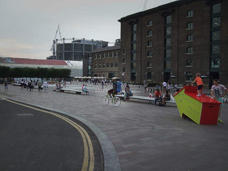
Granary Square. © Emma Knowles
In the USA, the definition of POPS is closely tied to the space’s provision as part of the planning process, and it is not only abroad that public space forms a part of developments; take for example, Granary Square near Kings Cross station, and much of the new Nine Elms development. It is not possible, however, to apply this distinction in London with the information available.
Using the new definition, we queried the GiGL datasets to identify spaces we thought qualified as POPS. Ownership of these sites was then further investigated using Land Registry data. There followed much discussion with The Guardian to check the final site list was as complete as possible for this stage.
In a first for GiGL, the dataset has been released as open data, with the data owners’ permission. This means that anyone is free to use the information for any purpose. More information on the open POPS dataset is available on the GiGL website, and the dataset can be downloaded from the Greater London Authority’s datastore. As an organisation, we’re committed to the open data agenda and plan to release more GiGL data extracts over the coming months.
We know there are probably many more POPS than we have currently identified, but hope to continuously add to and re-release the dataset as more information becomes available. If you can help identify additional POPS, you can so do here. We feature the POPS data on our website here.
1. Privately Owned Public Space: The New York City Experience, by Jerold S. Kayden, The New York City Department of City Planning, and the Municipal Art Society of New York, published by John Wiley & Sons, 2000↩
Can I get the map of POPS of London? Just didn’t find it in your website, thanks!
You can find the POPs dataset available to download and view on the London Datastore here: https://data.london.gov.uk/dataset/privately-owned-public-spaces.