What is the GiGL data exchange?
Curating the GiGL database is a continuous process. We receive new wildlife data from recorders across London, new site surveys occur and result in updated habitat data or new sites designations, and we’re continually working with our wonderful network of experts to verify the data in our systems.
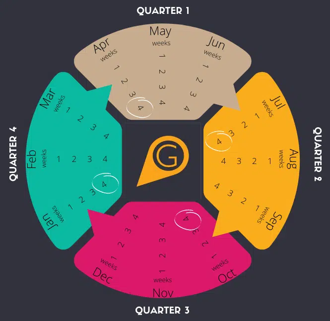
At GiGL we have direct access to the most up-to-date version of our databases, which we can use to answer queries from our clients, or extract data samples to share in response to ad-hoc requests from partners. Part of the service that we provide specifically to our Service Level Agreement (SLA) partners is to ensure that they can also access this data on their own systems. Every quarter we send copies of the data that represent snapshots of the database at those times. This “data exchange” is usually during the last week of April, July, October and January. If the most up-to-date data is needed before the end of a quarter then we can provide it on request.
Which data are provided?
Our SLA partners currently include four-fifths of the local authorities, charities such as the London Wildlife Trust and the National Trust, and utility and transport companies such as TfL. Partners receive data for their area of operation – for example a borough, a railway network, particular parks or the whole of London – with a buffer area (usually 500m) around it to provide context for the edges, and capture more mobile or less precisely recorded species records relevant to the area.
The data we manage comes from many sources, and we have processes to validate and standardise the data that we receive. Datasets includes species, habitats, open spaces, urban greening features, and non-statutory designated sites. We also provide a comprehensive set of statutory nature conservation designations. Whilst these are Natural England data they have been enhanced by GiGL to meet London data standards, and in the case of Local Nature Reserves the dataset includes additional data provided locally.

London has a network of non-statutory local wildlife sites known as Sites of Importance for Nature Conservation (SINCs). These are designated by the local authorities, who share SINC data with us for standardisation into a regional dataset. Each site has a citation document which details the reasons for it’s designation. From the SINC dataset we model areas of deficiency (AoD) in access to nature. GiGL also manage datasets of regionally and locally important geodiversity sites.
The open space sites data include protected Public Open Space designations where applicable. From these GiGL model areas of deficiency (AoD) in access to designated Regional, Metropolitan, District and Local, Small and Pocket Parks. Two subsets of the sites data are also provided: Privately Owned Public Open Spaces and Sites to Visit, which contains accessible open spaces that are provided to the public as a destination for leisure, activities and community engagement.
GiGL provides habitat survey data, alongside modeled Biodiversity Action Plan (BAP) condition and suitability mapping. The latter relates to a one off project from 2009. We also provide datasets of street and park trees and other urban greening features, such as green walls, living roofs and important Thames jetty bird roost sites.
The species database is divided by the precision of records: records mapped to 1m, 10m or 100m grid squares are provided as point data, records mapped to larger 1km, 2km or 10km grid squares are provided as polygon data. Protected and notable species and London Invasive Species Index (LISI) species are provided as subsets because these are frequently of interest. For partner’s whose operational area covers the whole, or majority, of London the database is further subdivided to provide files of historic records (those recorded more than 30 years ago), bird records, plant records and finally records of all other taxa. This is to prevent the files becoming too big to be easily used. Partners can additionally request custom data subsets as part of their regular updates, for example a file of recent bat records for use in screening planning applications.
The data exchange can include up to 34 different data files and several hundred citation documents. Whilst this large number of files could appear daunting to a new recipient, the data is accompanied by a README file that provides an overview and a Data Guide document, which explains all of the datasets. There is also further information on each dataset on our website and the GiGL team are always on hand to answer questions and provide training.
The data are shared under a Data Use Licence, which specifies that it is for internal use only unless with specific permission from GiGL. This is so we can ensure that the data are used in accordance with any terms specified by the data providers.
In what format are the data?
GIS files are the most effective way of storing and sharing map data. They enable attribute information about an object (e.g. species name, date recorded, etc.) to be stored alongside geographical information, allowing the information to be analysed together using GIS software such as Q, ArcGIS or MapInfo. They make maps that are interactive – changing resolution as you zoom in and out, allowing different layers to be displayed and hidden, and different labels and colour schemes to be applied. GIS also allows data to be interrogated and analysed automatically, for example to find the species and habitats within a site. Some skills and software are needed to get the most out of GIS files, so GiGL offer GIS advice and training sessions for our partners. We’re also currently looking into additional ways of displaying data exchange data for ease of reference to non-GIS users. Designated sites have additional information within indexed Word documents, which allows for more text than can fit in GIS.
Our internal database goes beyond GIS files and Word documents, with most datasets being connected to databases in SQL, Access or Recorder 6 which store and connect to additional information. So, if you can’t see what you are looking for in the data exchange files, ask us and we may well be able to help.
Why data “exchange”?
We use the term “data exchange” because it is part of a two-way flow of data. As well as receiving data from us, our partners are also generating new data. This could be through, for example, an open space survey, designation of new SINCs or receiving species records from local community groups. We have data standards guides available to assist surveyors. Our partners’ invaluable local expertise also means that they can spot when known information is missing from GiGL’s resource. So, when we send data, we know that more data will come back to us in the future.