The London Habitat Suitability maps provide a visual overview of the Biodiversity Action Plan (BAP) habitat suitability dataset. The maps are based on a data model produced and hosted by GiGL for the London Biodiversity Partnership’s Regional Delivery Framework (now disbanded).
The data and maps can help identify areas which would give the best benefit to biodiversity, if used to create nine BAP priority habitats in London (more information about London’s BAP here.)
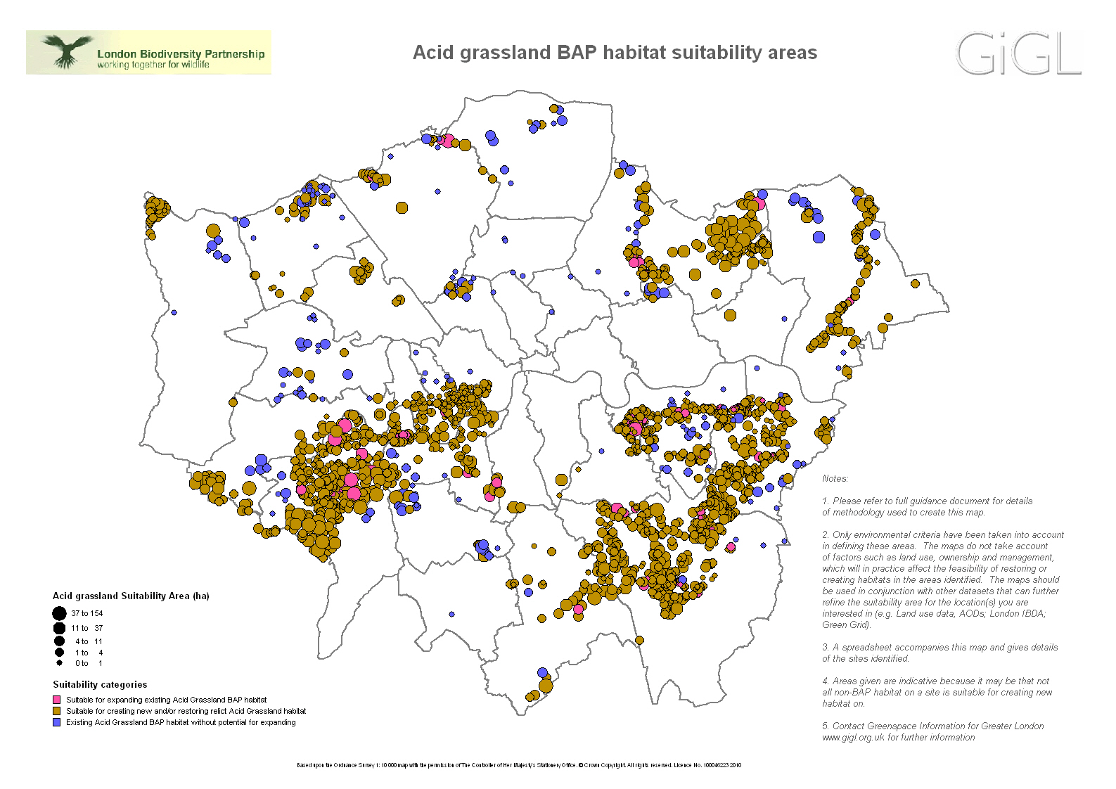
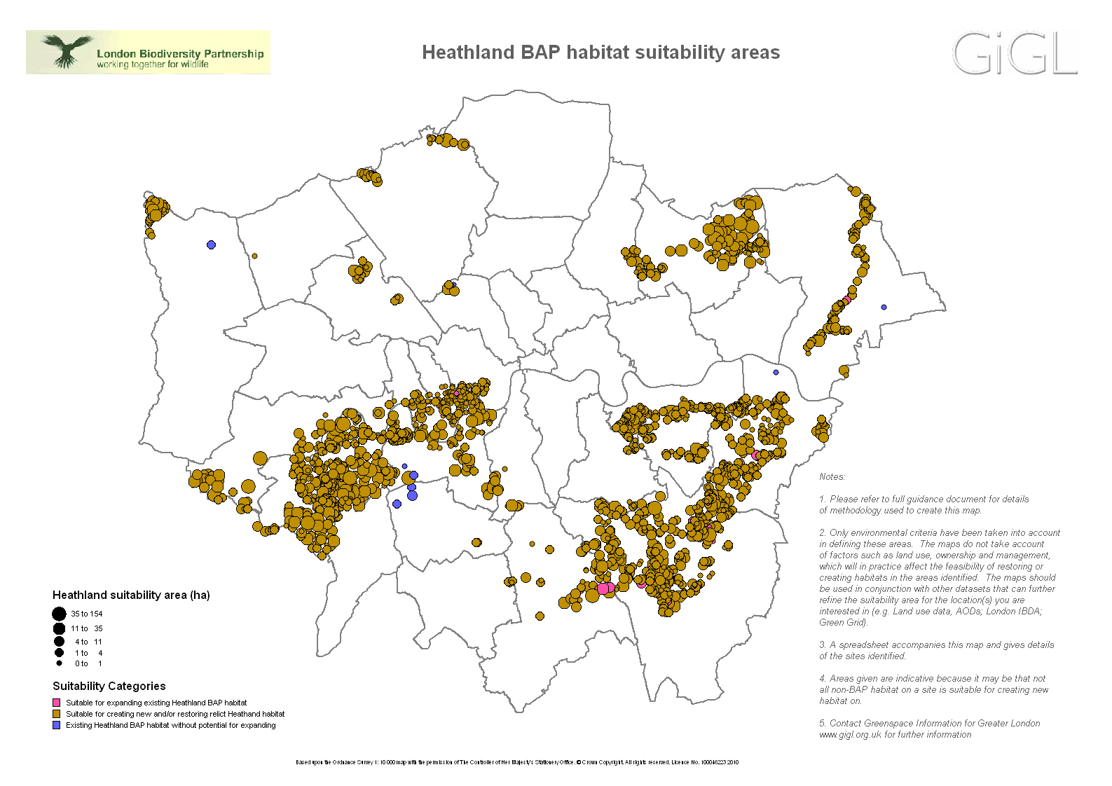
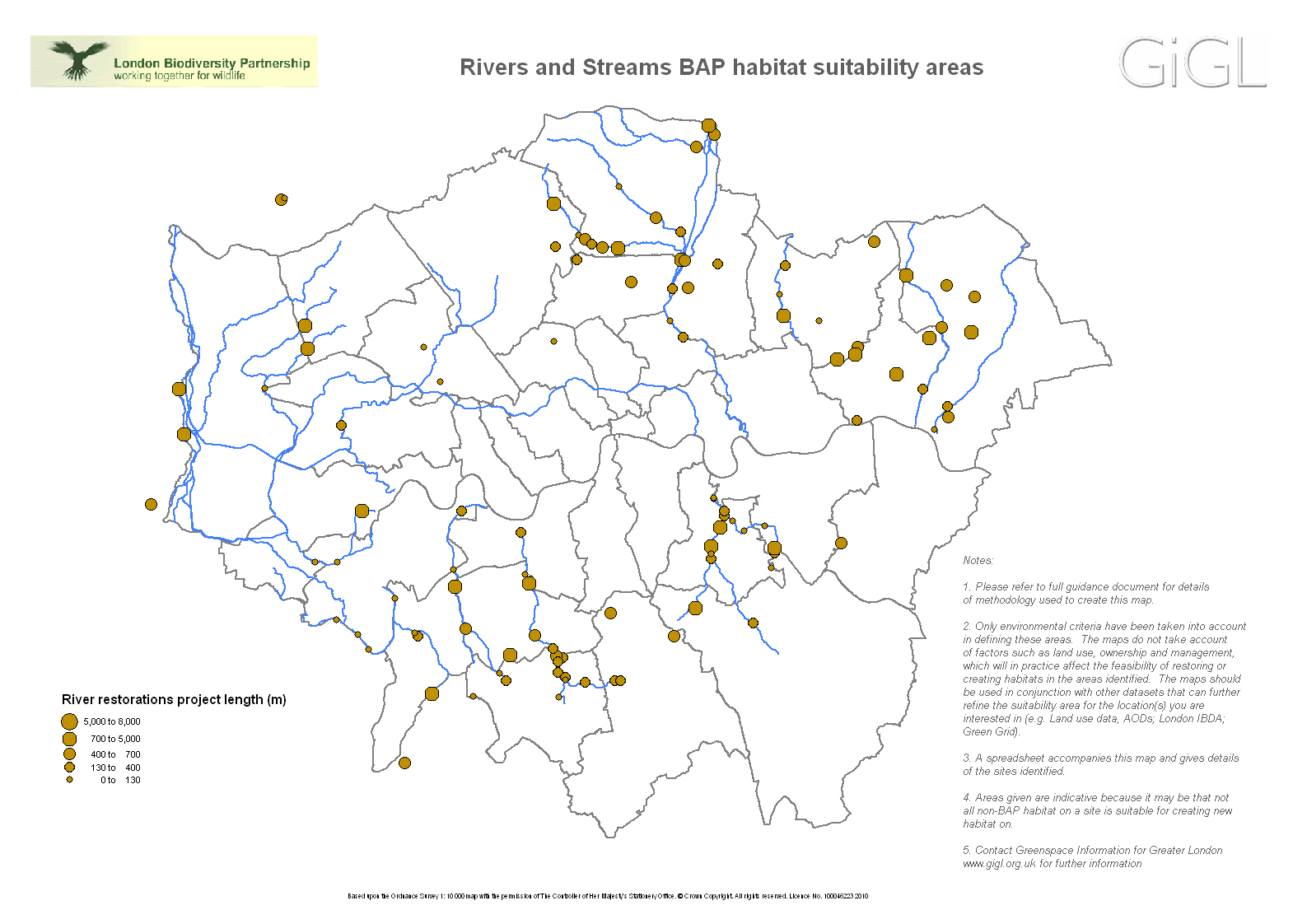
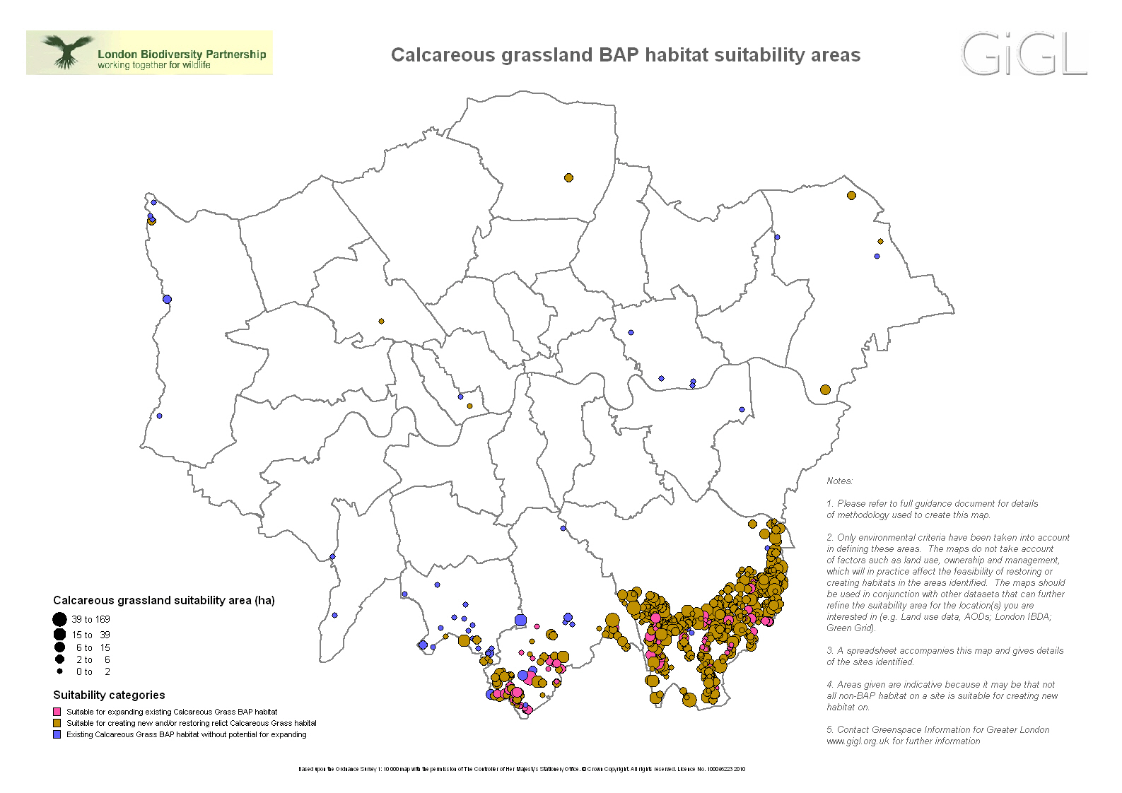
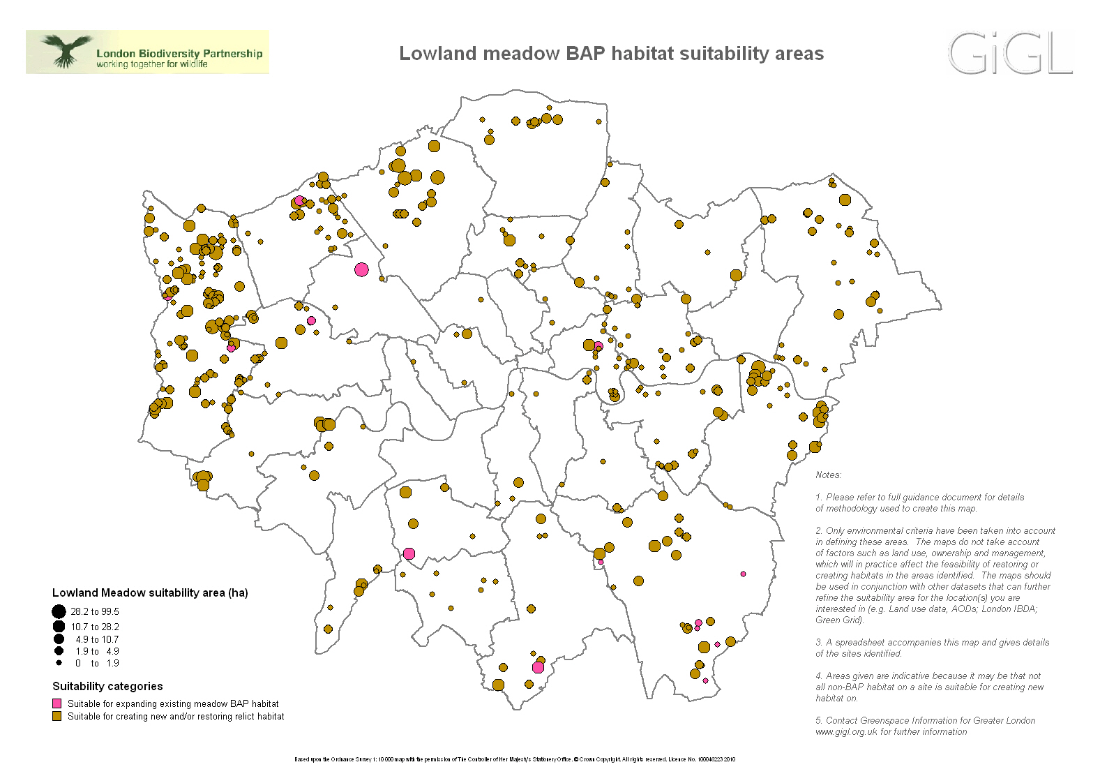
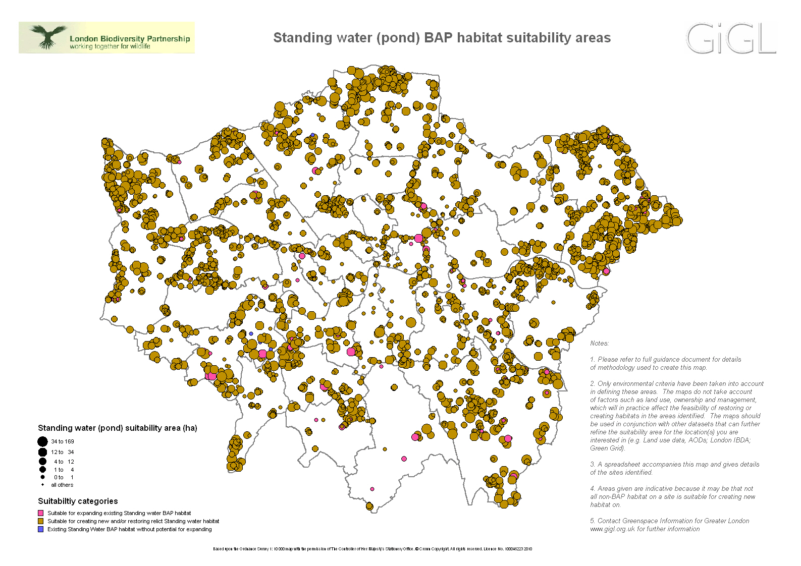
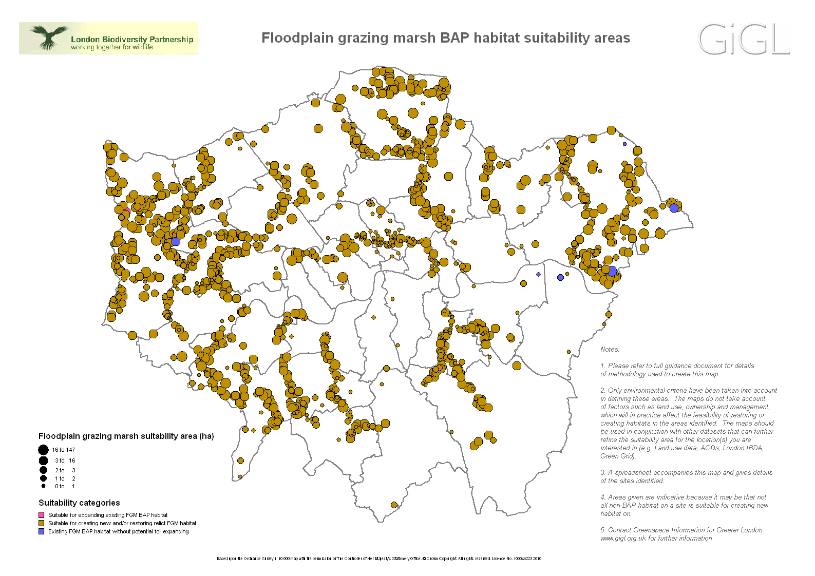
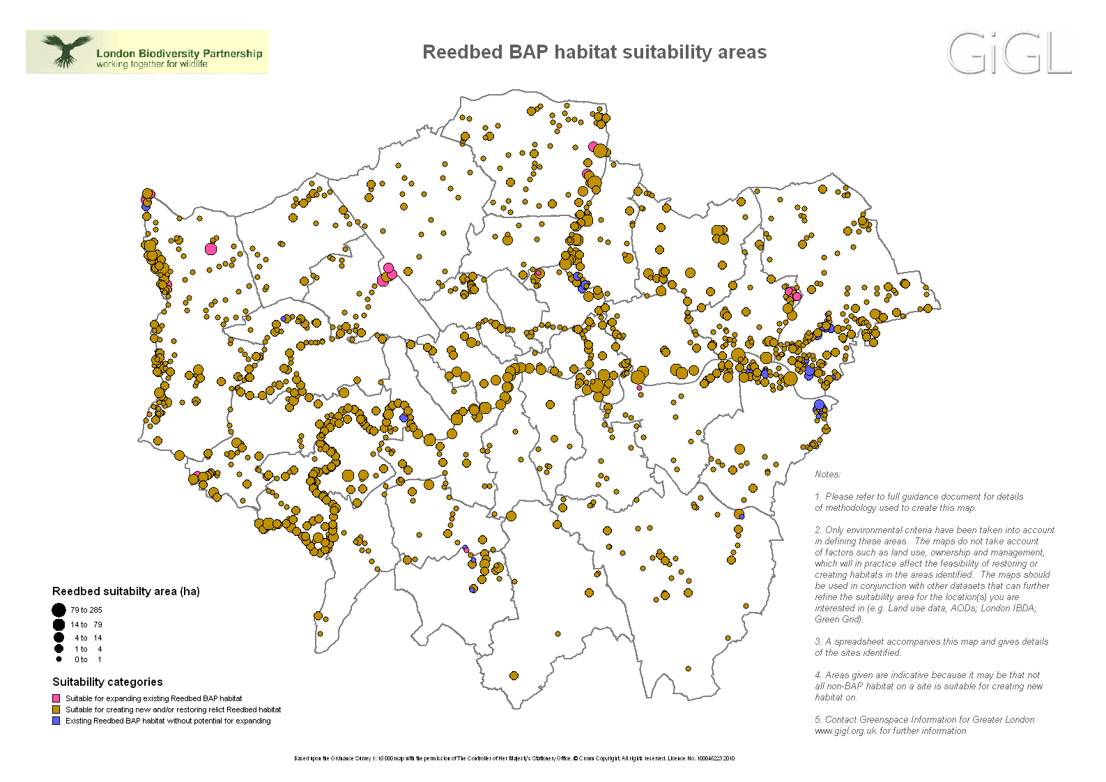
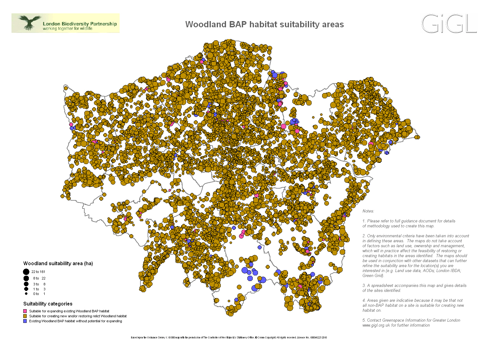
The maps identify areas where data analysis suggests existing habitat could be expanded without negatively affecting other important habitats. They also suggest areas that are ecologically suitable for the creation of new BAP habitat.
Only ecological criteria possible to determine from various input data have been taken into account in defining these areas. The maps do not take account of factors such as land use, ownership and management, which will in practice affect the feasibility of restoring or creating habitats in the areas identified. However, these data can be cross-referenced with other datasets, such as GiGL’s open space data for further refinement. See how GiGL partner TfL (London Underground) used the data here.
Full site information from this dataset is available to GiGL partners, under the standard data use license.
Regional dot maps and spreadsheets are available to download below, (see website terms regarding use).
Download guidance for interpreting the maps here.